NOTICE: THIS IS A HIGH ALTITUDE ATTRACTION. PEOPLE USED TO LIVING IN LOWLAND AREAS SHOULD BE AWARE OF AND PREPARED FOR POTENTIAL BREATHING AND EXHAUSTION ISSUES.
- The Basics:
- Park is open early June- mid October only- check website for exact dates!
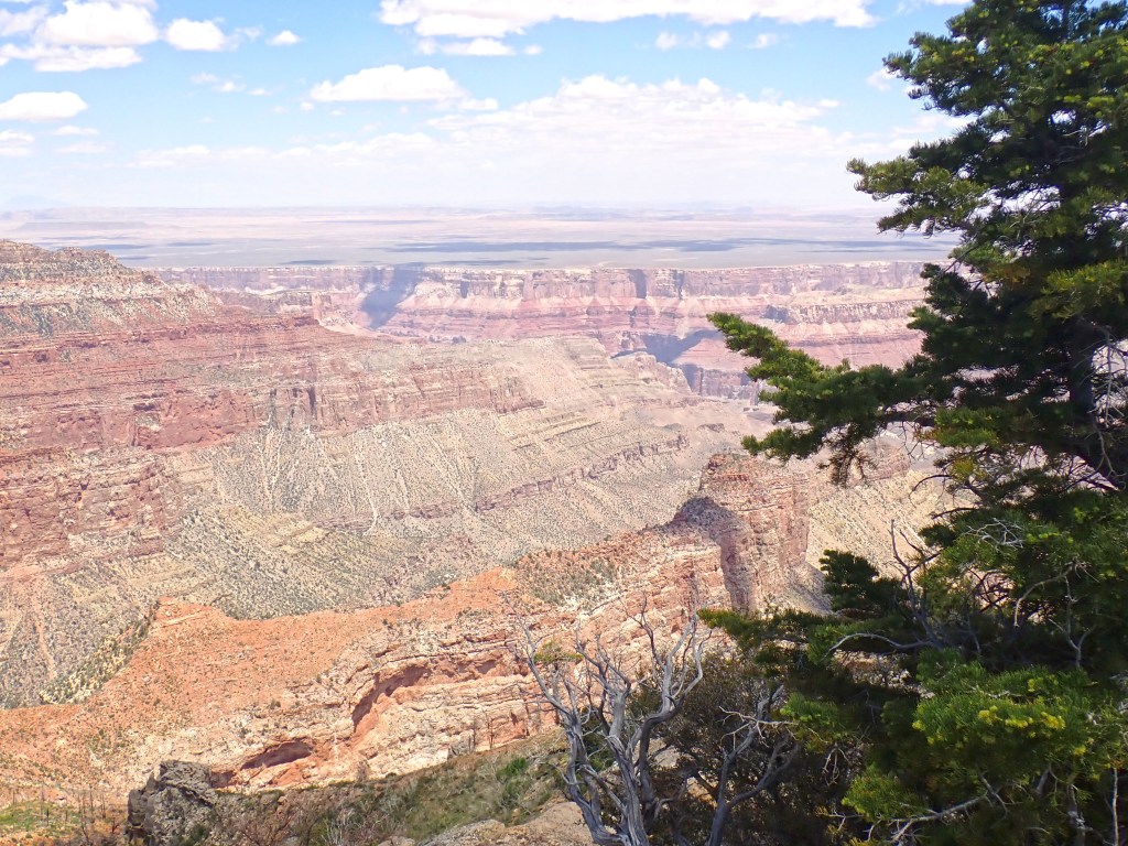
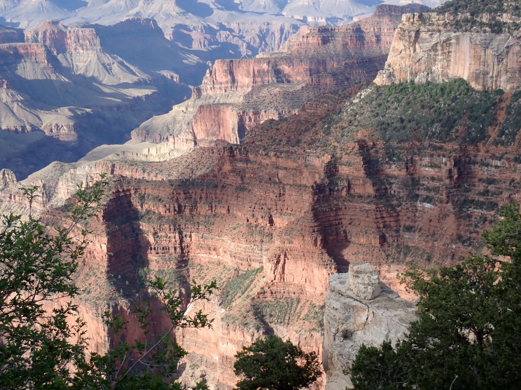
- The North Rim
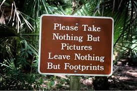
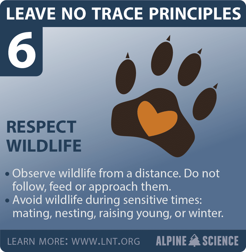
- Please Practice Leave No Trace
- What to Pack in Your Day Backpack
- Day Hikes at The North Rim- Courtesy of the National Park Service
- https://www.nps.gov/grca/planyourvisit/day-hiking.htm#CP_JUMP_1904239
- North Rim Day Hikes
- Let’s Go Tour!
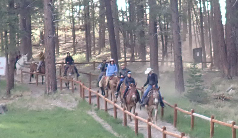
- Mule Rides:
- Grand Canyon Scenic Drive:
- Jacob’s Lake-
“The wonders of the Grand Canyon cannot be adequately represented in symbols of speech, nor by speech itself.”
– John Wesley Powell
The Basics:
Park is open early June- mid October only- check website for exact dates!
Website: https://www.nps.gov/grca/planyourvisit/north-rim.htm
Grand Canyon North Rim Lodge https://www.grandcanyonnorth.com/
Grand Canyon North Rim Camping Ground- Reservations Required https://www.recreation.gov/camping/campgrounds/232489
North Rim Mule Trips https://www.canyonrides.com/grand-canyon-mule-ride/
North Rim Visitor Center: Open daily 8 am-6 pm when PARK IS OPEN!
Gas- there is a 24 hour gas station near the camping grounds. There is one in Jacob’s Lake, a nearby town.
Food- There is a restaurant in the Grand Canyon Lodge. Most of the food is extremely expensive.
The North Rim
Visited by only 10% of all park visitors.
Located at a higher elevation than the Southern Rim- 8,000 feet. This means it can be very cool in the evenings and mornings- it was 32 degrees when we visited on Memorial Day 2022! So layer appropriately.
Hiking across the Grand Canyon from South Rim to North Rim is 21 miles (34 km)
Driving from South Rim to North Rim is 4.5 hours- 220 miles (354 km)

Please Practice Leave No Trace


What to Pack in Your Day Backpack

Navigation: map, compass, altimeter, GPS device, personal locator beacon (PLB) or satellite messenger
Headlamp: plus extra batteries
Sun protection: sunglasses, sun-protective clothes and sunscreen
First aid including foot care and insect repellent
Knife plus a gear repair kit
Fire matches, lighter, tinder and/or stove
Shelter carried at all times (can be a light emergency bivy)
Extra food Beyond the minimum expectation
Extra water Beyond the minimum expectation
Extra clothes Beyond the minimum expectation


Day Hikes at The North Rim- Courtesy of the National Park Service
https://www.nps.gov/grca/planyourvisit/day-hiking.htm#CP_JUMP_1904239
North Rim Day Hikes
Bright Angel Point Trail
0.5 mi. / 0.8 km round-trip; 30 minutes approximate round-trip hiking time. A short walk n a paved trail to a spectacular view of the canyon. The trail begins at the log shelter in the parking area by the visitor center or at the corner of the back porch behind the lodge. Self-guiding nature trail pamphlets are available from a box along the trail.
Transept Trail
3.0 mi. / 4.8 km round-trip; 1.5 hours approximate round-trip hiking time. Follows the canyon rim from Grand Canyon Lodge to the North Rim Campground.
Bridle Trail
This trail follows the road as it connects the Grand Canyon Lodge with the North Kaibab Trailhead, a distance of 1.2 miles / 2 km one-way. Pets on leash and bicycles are permitted on this hard-packed trail.
North Kaibab Trail
Distance and hiking times vary. This is the only maintained trail into the canyon from the North Rim. Even a short hike to Coconino Overlook (1.5 miles / 2.4 km round-trip) or Supai Tunnel (4 miles / 6.5 km round-trip) can give you an appreciation for the canyon’s rich natural beauty and immense size. A hike to Roaring Springs and back is extremely strenuous and takes a full day (7-8 hours) – begin your hike before 7 a.m. Roaring Springs lies 3,050 feet / 930 m below the canyon rim and is 9.4 miles / 15 km round-trip. A day hike beyond Roaring Springs is not recommended. Many years of experience have shown that hikers who proceed beyond this point during the hottest parts of the day have a much greater probability of suffering from heat-related illness, injury, or death. This trail is also used by mules. NOTE: Round trip to the Colorado River is 28 miles / 45 km and trail descends almost 6,000 ft. / 1,800 m. Under no circumstances should you attempt to hike from the rim to the river and back in one day! Do not hike during the hottest part of the day.
Ken Patrick Trail
10 mi. / 16 km one-way; 6 hours approximate one-way hiking time. Winds through the forest and along the rim from Point Imperial to the North Kaibab Trail parking area.
Uncle Jim Trail
5.0 mi. / 8.0 km round-trip; 3 hours approximate round-trip hiking time. Winds through the forest to a point overlooking the canyon and the North Kaibab Trail switchbacks. Begins at the North Kaibab Trail parking lot. This trail is also used by mules.
Widforss Trail
10 mi. / 16 km round-trip; 6 hours approximate round-trip hiking time. Blends forest and canyon scenery. Even a short walk can be very satisfying. Take the dirt road 1/4 mile/0.4 km south of Cape Royal Road for 1 mile / 1.6 km to the Widforss Trail parking area. Self-guiding trail brochure available at trailhead.
Arizona Trail
The Arizona Trail is an ambitious project that traverses the length of Arizona from the Utah border to Mexico. A section of this trail enters the park near the North Entrance and roughly parallels the highway until it connects with the North Kaibab Trail, a distance of approximately 10 miles / 16 km.
Cape Royal Trail
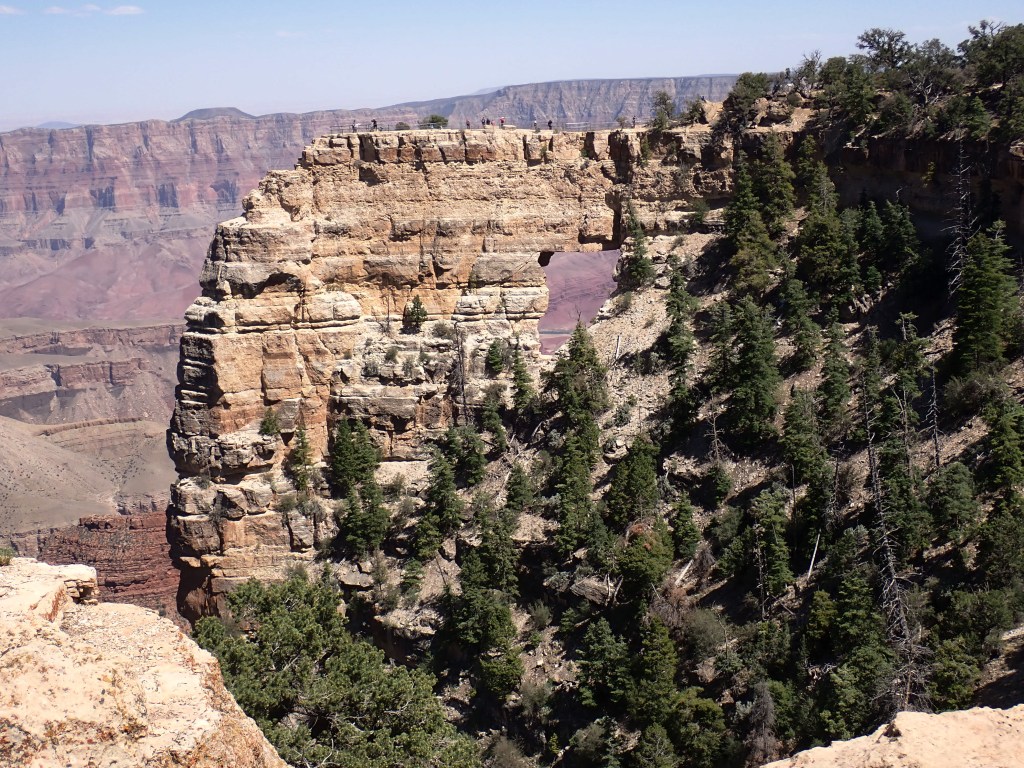
0.6 mi. / 1.0 km round-trip; 30 minutes approximate round-trip hiking time. An easy walk on a flat, paved trail providing views of the canyon, Angels Window, and the Colorado River. Markers along the trail interpret the area’s natural history. Trail begins at the southeast side of the Cape Royal parking area.
Cliff Springs Trail
1.0 mi. / 1.6 km round-trip; 1 hour approximate round-trip hiking time. Meanders down a forested ravine and ends where a chest-high boulder rests under a large overhang. The spring is on the cliff side of the boulder. Please do not drink the water as it may be contaminated. Trail begins directly across the road from a small pullout on a curve 0.3 miles / 0.5 km down the road from Cape Royal.
Cape Final Trail
4.0 mi. / 6.4 km round-trip; 2 hours approximate round-trip hiking time. A 2-mile walk from dirt parking area to Cape Final. This trail offers a view of the canyon.
Roosevelt Point Trail
0.2 mi. / 0.3 km round-trip; 20 minutes approximate round-trip hiking time. This trail is a short, secluded woodland loop with spectacular views. Offers benches for relaxed enjoyment of the canyon.
Point Imperial Trail
4.0 mi. / 6.4 km round-trip; 2 hours approximate round-trip hiking time. This easy trail passes through areas burned by the 2000 Outlet Fire and ends at the north park boundary. From there connections are possible to the Nankoweap Trail and U.S. Forest Service roads.
Let’s Go Tour!
Visitor Center- The best place to start your adventure. Here you can pick up maps, junior ranger booklets, and speak to rangers who can help you plan your day to ensure you take in all the major sites. The Visitor Center also supplies souvenirs, and the all important restrooms. The Visitor Center is located next to the Grand Canyon Lodge- home to the restaurant, mule rides check-in, etc.
Bright Angel Point– head into the Grand Canyon Lodge and out to the overlook. You can pass some time in rocking chairs admiring the overlook. Then follow the trail to Bright Angel Point. You can also pick up the trail on Bridle Pass located behind the Visitor Center. The trail is about 0.5 mi long with no significant change in elevation. Allow at least 30 minutes.
Mule Rides:
It is a classic image of touring the Grand Canyon. Mule Rides are available at the North Rim- reservations https://www.canyonrides.com/grand-canyon-mule-ride go fast! Weight limits apply. Trail rides vary in length.

Grand Canyon Scenic Drive:
This 23 mile drive has numerous pull outs to check out fabulous views or to pick up a trail head. Some people prefer to drive to the end and work their way back to the lodge and catch Bright Angel Point at sunset. Begin at the Visitor Center and head north on North Rim Parkway (State Road 67).
Cape Royal Road- will drive past ponderosa pines, aspens, spruce and fir. It will also pass several areas devastated by forest fire. at the Y intersection bear LEFT towards Point Imperial- the highest elevation in the park.


Turning Right at the Y intersection:
2.5 miles- Greenland Lake (not well marked) which is actually an ephemeral pond developed from sinkhole- 200 yard trail counterclockwise leads you to a cabin that was used to store salt for cattle.
2 miles more- Vista Encantado. See Nankoweap Creek, Vermillion Cliffs, and Roosevelt Point.
1.5 miles more- Confluence of the Little Colorado and Colorado River
Follow road to end: Angel’s Window, a natural arch with a window


Jacob’s Lake-
After leaving the National Park- you will reach the intersection with Jacob’s Lake- a great place to fill up the car with gas, shop for souvenirs and pick up some awesome snacks- from homemade cookies to ice cream. It is a little gem of place to stop before heading to your next destination.

ancient publeon Casa Riconda Chacoan Great Houses Chaco Culture National Historical Park cliff palace Hugo Pavi isla mujeres Junior Park Ranger program Kivas long house mesa verde Mesa Verde audio tour mug house National Park North Beach petroglyphs Petroglyph trail Pueblo Bonito Pueblo del Arroyo Recreation.gov reviews Square House Tower Supernova tour ultramar Una Vida Wetherill mesa whale shark snorkel
