“Those who contemplate the beauty of the earth find reserves of strength that will endure as long as life lasts.”
—Rachel Carson
NOTICE: THIS IS A HIGH ALTITUDE ATTRACTION. PEOPLE USED TO LIVING IN LOWLAND AREAS SHOULD BE AWARE OF AND PREPARED FOR POTENTIAL BREATHING AND EXHAUSTION ISSUES.
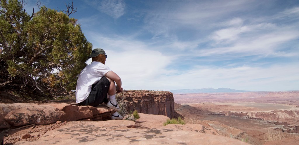
Table of Contents
- Table of Contents
- Demographics:
- Admission:
- Packing Your Hiking Daypack
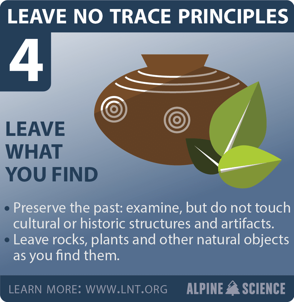
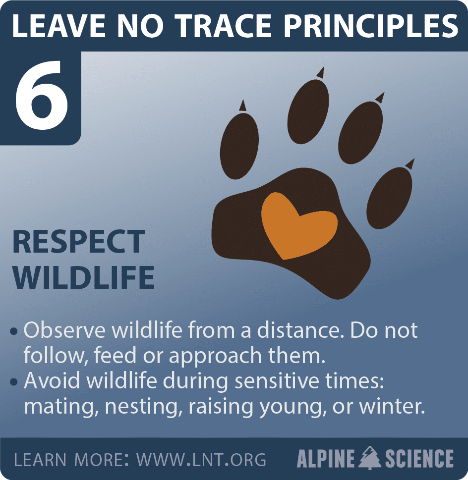
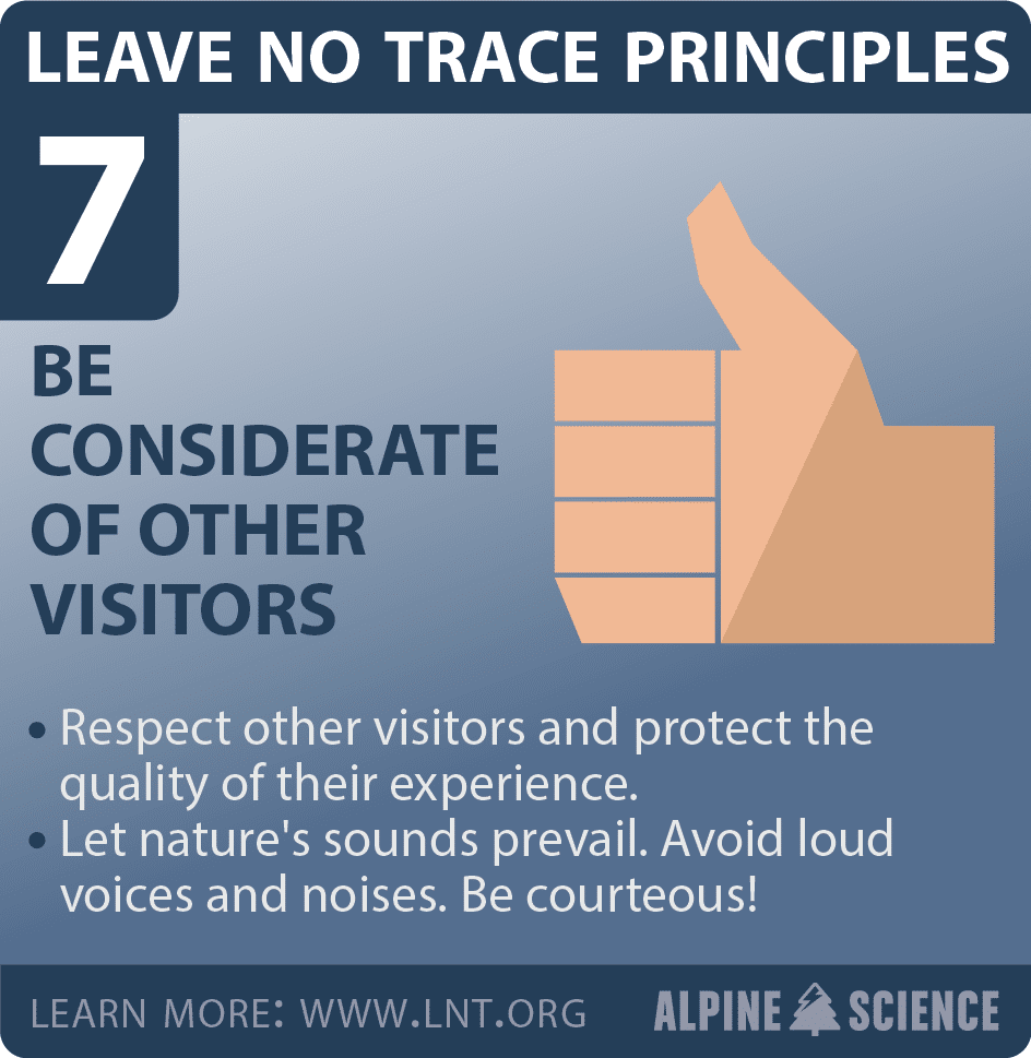
- Please Preserve Our National Parks- Practice Leave No Trace
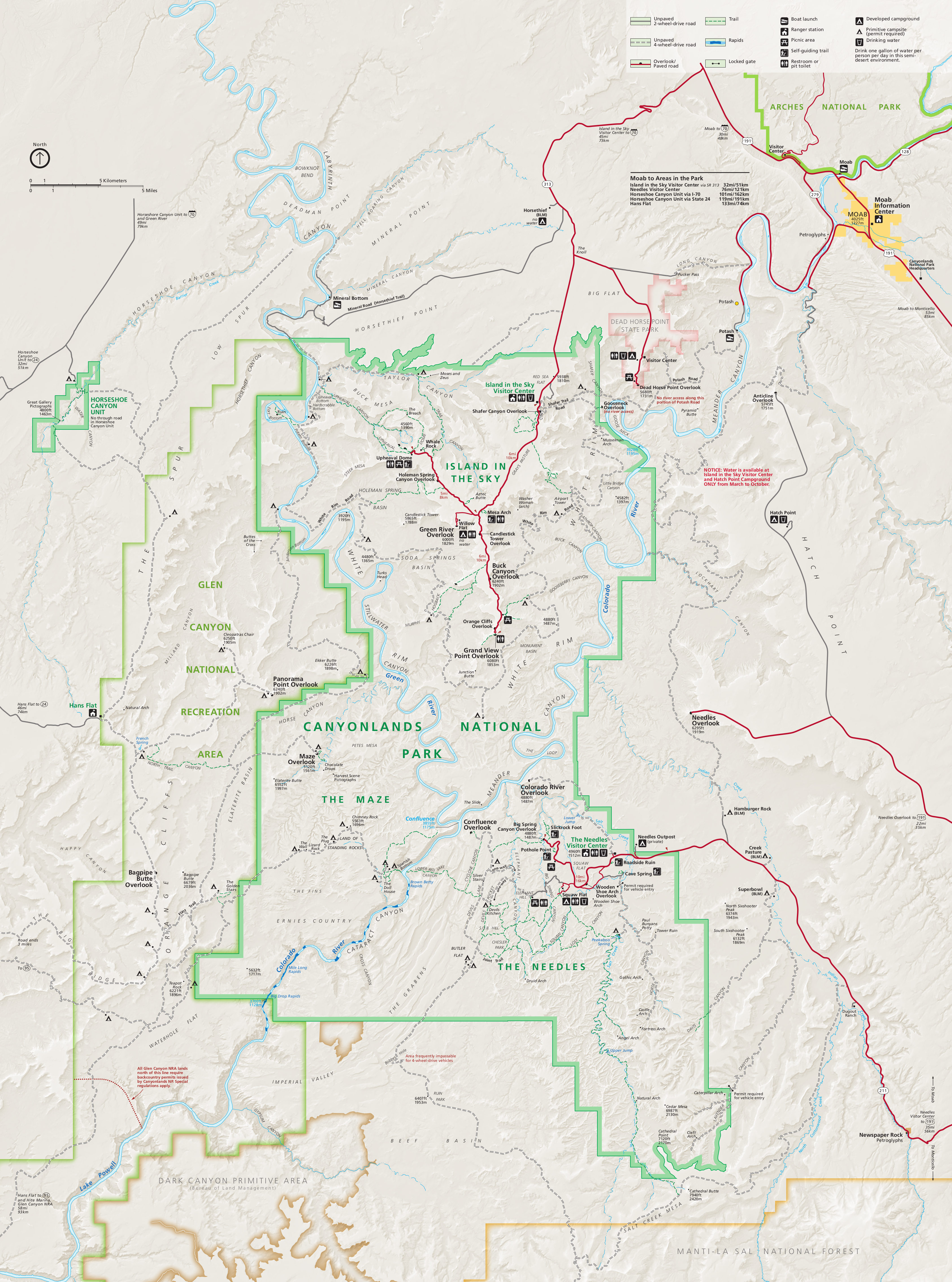
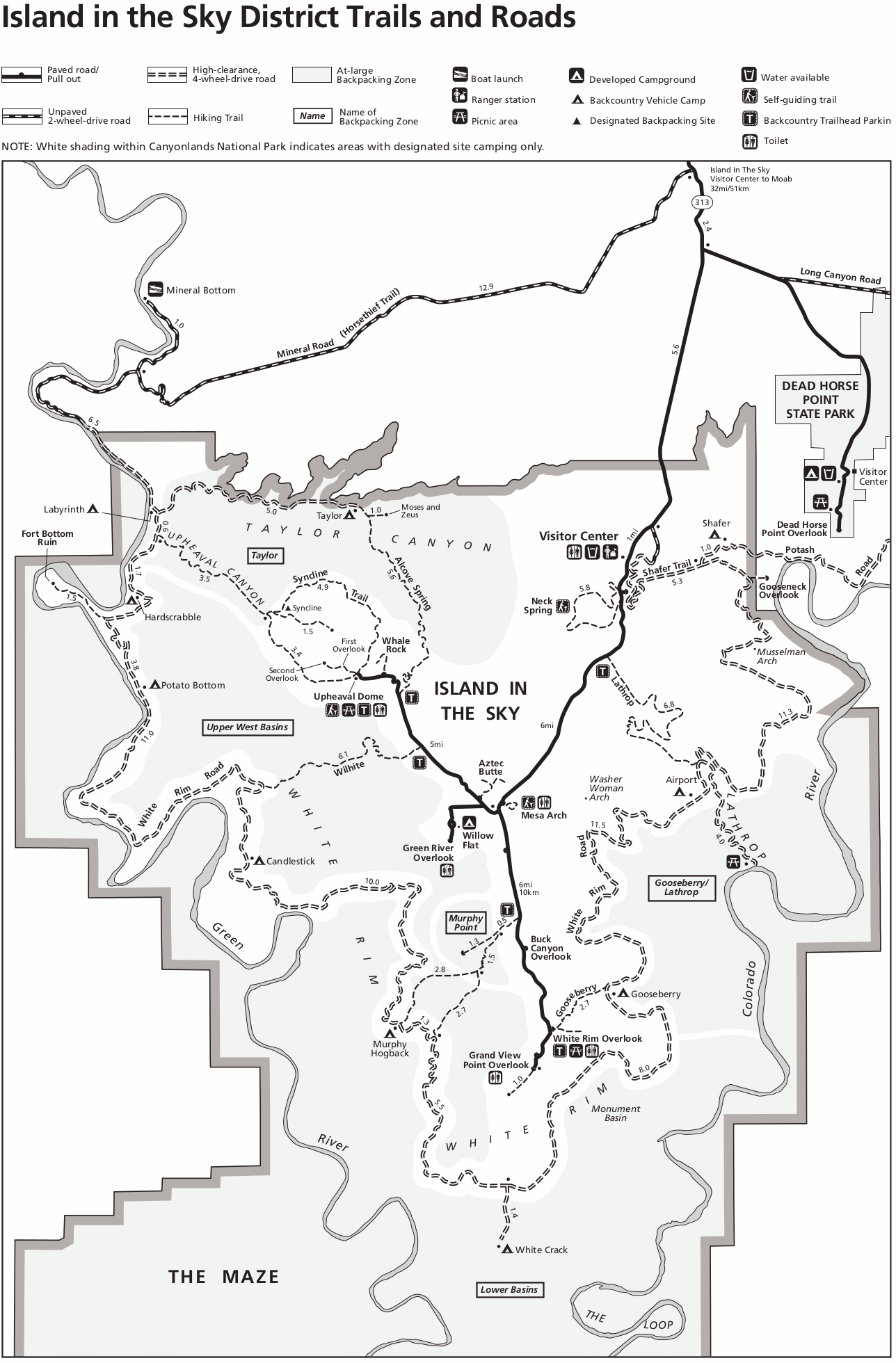
- Let’s Go Tour- Island of the Sky
- Island of the Sky- Trail and Roads Map
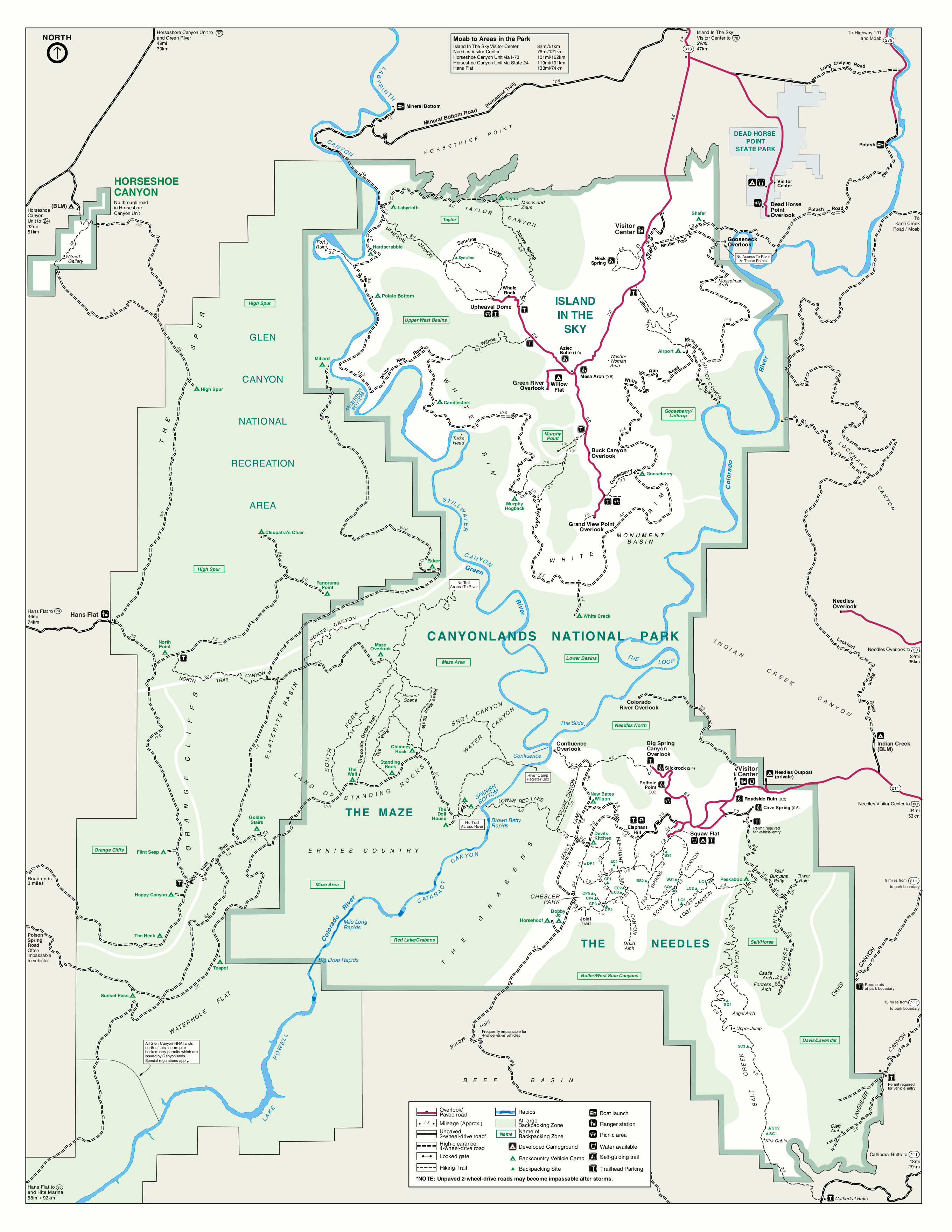
- Canyonlands Complete Hiking Trail Map
- Mesa Top Loop- Easy Hiking Trails
- Moderate Mesa Top Loop Hiking Trails
- Mesa Top Loop To White Rim Trails
- Trails Along the White Rim Road
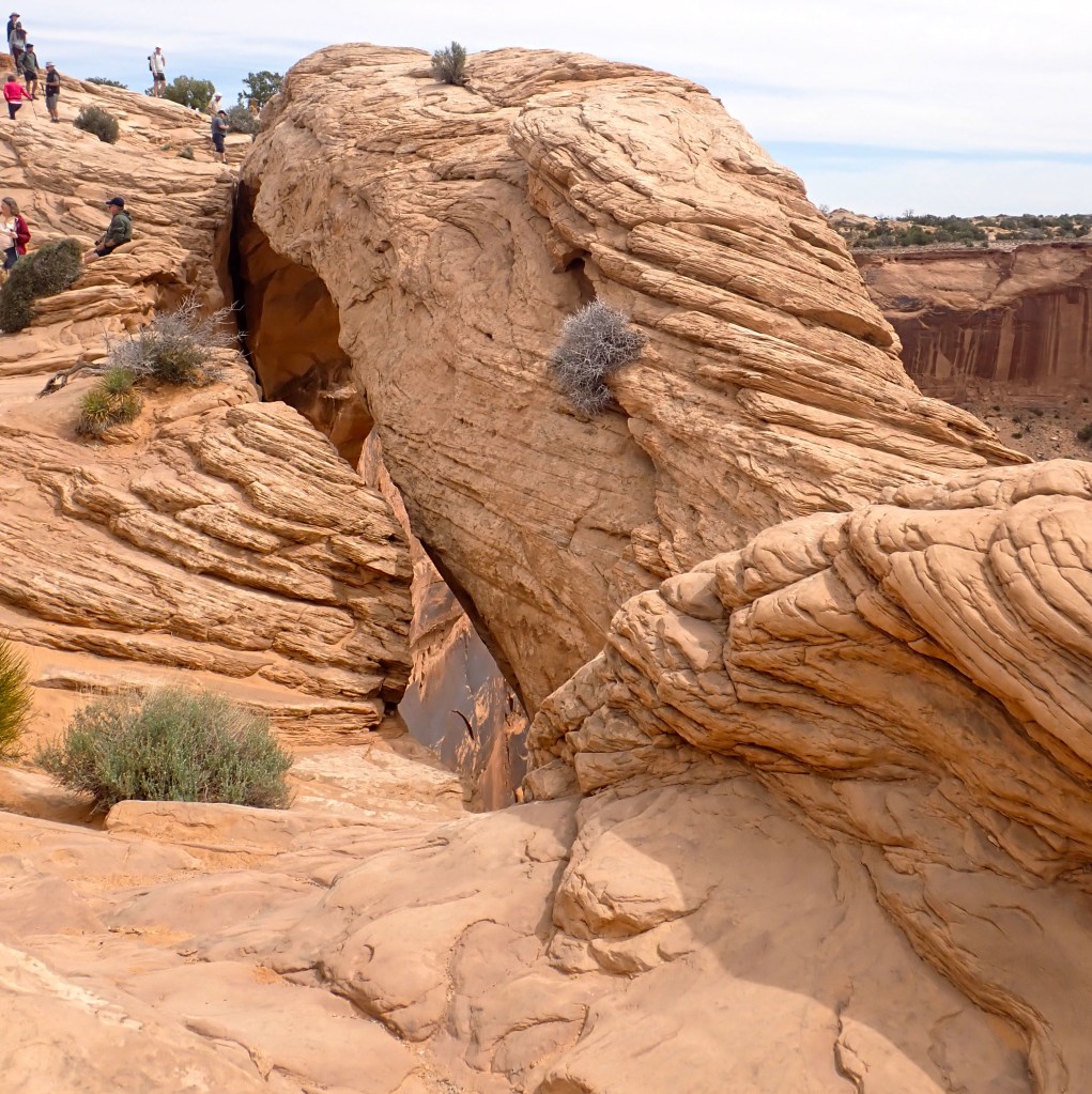
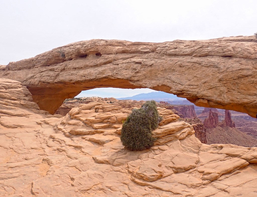
- Mesa Arch-
- Upheaval Dome- First and Second Overlook:
- Grand View Point:
Demographics:
Website: https://www.nps.gov/cany/planyourvisit/index.htm
Canyonlands, established September 12, 1964, is located in the southeastern area of Utah, approximately an hour’s drive from Moab. The park is comprised of 337,598 acres or 528 square miles and averages over 900,000 visitors/year. Canyonland’s lowest point of 3,750 feet is located near the Colorado River while its highest peak is at 7,120 feet at Cathedral Point.
Canyonlands is divided into 3 areas: Each area must be visited individually- there are no bridges, tolls or other connections. Drive times between park sections range from 2-6 hours. There is NO bus system within the park- a car is essential.
Island in the Sky- located in the northern section of the park, approximately 40 minutes from Moab. Most visited section. Take US 191 north of Moab, UT 313
Needles District- located in the southeast section of the park, approximately 90 minutes from Moab. Take US 191 south of Moab, UT 211
The Maze District- is the most remote. All roads require a high clearance 4×4 vehicle. Check road clearance before planning travel at this site https://www.nps.gov/cany/planyourvisit/road-conditions.htm
Google Driving Directions– https://www.google.com/maps/place/Canyonlands+National+Park/@38.2271581,-110.1814812,10z/data=!3m1!4b1!4m5!3m4!1s0x8747e1ee4518a6a9:0x15a452a9c502e6aa!8m2!3d38.2135733!4d-109.9025345
Admission:
Hours– The park is open 24 hours/day, 7 days a weeks- 365 days a year.
Fees– All fees are valid for 7 days from purchase: private cars- $30, motorcycles- $25, person- $15. There are also passes that can be used- such as the America the Beautiful Pass which provides access to all National Parks and other sites for a calendar year for the price of $80. For a list of other accepted passes- https://www.nps.gov/cany/planyourvisit/fees.htm
Cell Phone– public wi-fi can be found at the Visitor’s Centers in Island of the Sky and the Needles. There are no outlets available for charging. Cell phone coverage outside of the Visitor Center is sporadic or absent. There is no coverage in the Maze.
Food– There are no food service vendors in Canyonlands. Prepackaged snacks and bottled water can be found at the Visitor Center. The drive to Moab is approximately 40-60 min. Make sure you have all the food and liquid you need for the day. Beware that the mornings can start cool and it can be tempting to not pack a lot of water; however, the temperature will rise, coupled with elevation and exertion- and the risk for dehydration grows. A minimum of 2 liters of water/per person should be available at all times. Please also note that many restaurants are closed on Sundays in Utah- fast food and a few restaurants are open- however, it is best to make sure you know what your options are going to be in advance.
Weather- can change quickly. Check with park rangers before heading off on hikes. Be sure to have a hat, sunglasses, windbreaker, and sunscreen.
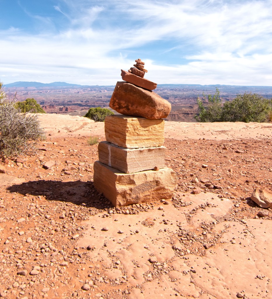
Hiking Etiquette– trails are often marked by piles of stones known as cairns. Please do not add stones, disturb the stones or create new ones as this could mislead hikers.There is NO potable water on the hiking trails.
Packing Your Hiking Daypack

Hiking requires serious preparation to avoid mishaps and other undesirable outcomes. The Boy Scout Motto “Be Prepared” ensures you are ready for any possibility. So here’s what needs to be in your pack!
Navigation Supplies: maps, compass are a must. Helpful are GPS, a personal locator beacon or satellite messenger
Headlamps/Flashlights– plus extra batteries
Sun Protection– sunglasses, sunscreen, sun protective clothing
First Aid– make sure you have moleskin or similar for footcare and insect repellant! Hiking specific kits are a good investment.
Knife– gear repair kit
Fire- matches or lighter
Shelter- emergency heat blankets (foil)
Extra Food– pack more than you will need
Extra Water– pack more than you will need. Consider purchasing a Filtration Straw that can be used if safe drinking water is not available.
Extra Clothing- socks, a jacket (layers work best), rain poncho, etc.
Hiking stores such as REI https://www.rei.com/learn/expert-advice/ten-essentials.html, L.L. Bean https://www.llbean.com/ are just a few stores that can assist you.
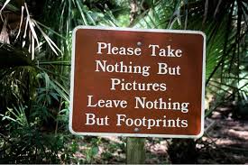
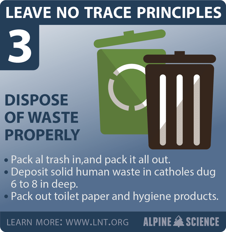
Please Preserve Our National Parks- Practice Leave No Trace


Let’s Go Tour- Island of the Sky
Most people elect to spend one day at Canyonlands Island in the Sky so planning what you want to see is important. Overlooks and hiking trail heads have parking lots- many of which will be full in peak season with overflow parking onto the road. Congested hiking paths at popular sites are common. The best suggestion-aside from a good plan- is to arrive early before 9:00 am- the earlier the better. This will allow you to enjoy the sights without crowds and make parking a lot easier. Canyonlands offers a wide variety of things to see. This page will only cover the sights that we visited- it would be presumptive to offer guidance otherwise.
The Visitor Center: (located on the Right side of the road) is the best place to begin. Here you can collect park information, maps, get your park passbook stamped, pick up a Junior Ranger Activity Book, get a schedule of activities and talk with the rangers. Restrooms are also available. Please note- the parking lot at the Visitor Center does not have a large capacity so during peak hours it might be difficult to find a spot.
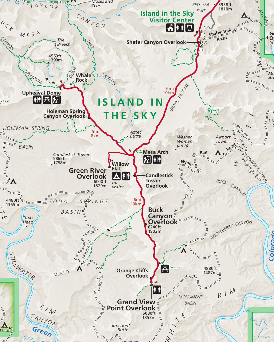
Island of the Sky- Trail and Roads Map
Canyonlands Complete Hiking Trail Map
Mesa Top Loop- Easy Hiking Trails
| Trail Name | Round Trip Distance | Round Trip Hiking Time | One Way Elevation Change | Description |
| Mesa Arch | 0.6 mi / 1 km | 30 minutes | 56 ft / 17 m | arch on cliff edge |
| Murphy Point Overlook | 3.4 mi / 5.5 km | 2 hours | 142 ft / 43 m | panoramic view w/ Henry Mtns |
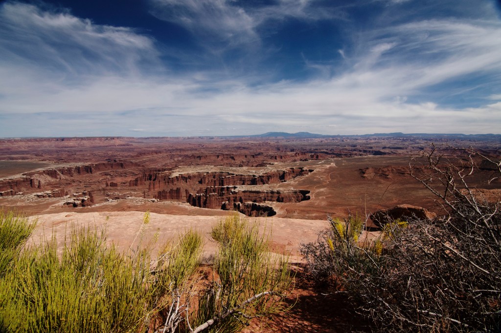
| White Rim Overlook | 1.8 mi / 2.9 km | 1.5 hour | 159 ft / 49 m | view of potholes, White Rim Road |
| Grand View Point | 1.8 mi / 2.9 km | 1.5 hours | 73 ft / 22 m | panoramic view along cliff edge |
Moderate Mesa Top Loop Hiking Trails
| Trail Name | Round Trip Distance | Round Trip Hiking Time | One Way Elevation Change | Description |
| Neck Spring | 5.6 mi / 9 km | 3 – 4 hours | 418 ft / 127 m | springs, evidence of ranching |
| Aztec Butte | 1.4 mi / 2.3 km | 1.5 hours | 222 ft / 68 m | steep slickrock to top, granaries |
| Whale Rock | 0.8 mi / 1.3 km | 1 hour | 141 ft / 35 m | bare slickrock, good views |
| UPHEAVAL DOME: | ||||
| to First Overlook | 0.6 mi / 1 km | 1 hour | 115 ft / 35 m | view into crater |
| to Second Overlook | 1.2 mi / 1.9 km | 1.5 hours | 114 ft / 35 m | crater & Upheaval Canyon view |
Mesa Top Loop To White Rim Trails
| Trail Name | Round Trip Distance | Round Trip Time | One Way Elevation Change | Description |
| Lathrop to Canyon Rim | 5 mi /8 km | 2-3 hours | 158 ft / 48 m | trail crosses open grasslands |
| Lathrop to White Rim Road | 11.8 mi / 19 km | 5- 7 hours | 1,721 ft / 525 m | views of Colorado River & La Sals |
| Murphy Loop | 10.8 mi / 17.4 km | 5 – 7 hours | 1,448 ft / 441 m | panoramic view from hogback |
| Gooseberry | 4.6 mi / 7.4 km | 4 – 6 hours | 1,529 ft / 466 m | views of cliffs & La Sal Mtn |
| Wilhite | 11.4 mi / 18.3 km | 6 – 8 hours | 1,693 ft / 516 m | slot cyn across White Rim Road |
| Alcove Spring | 11.2 mi / 18 km | 6 – 7 hours | 1,455 ft / 444 m | large alcove, views of Taylor Cyn |
| Syncline Loop | 8.1 mi / 13 km | 5 – 7 hours | 1,516 ft / 462 m | canyon hiking, some shade |
| —Upheaval Crater spur | 3 mi / 4.8 km | 2 hours | 350 ft / 107 m | some scrambling over rocks |
| —Upheaval Canyon spur | 7 mi / 11.2 km | 3 – 4 hours | 400 ft / 122 m | sandy hike along wash bottom |
Trails Along the White Rim Road
| Trail | Round Trip Distance | Round Trip Time | One Way Elevation | Description |
| Gooseneck Overlook | 0.6 mi / 1 km | 30 minutes | 98 ft / 30 m | excellent view of Colorado River |
| Fort Bottom Ruin | 3.4 mi / 5.5 km | 2 hours | 418 ft / 128 m | tower structure from ancient times |
| Moses and Zeus | 1.3 mi /2.1 km | 1 hour | 717 ft / 219 m | views of Taylor Cyn, climbing routes |
Mesa Arch-
Directions: Located a short distance from the Visitor Center on the Left Hand side of the road. Parking lot will most likely be full if visiting during peak times. Overflow parking goes out onto the edge of the road.
The hike is short-and again, likely to be crowded- especially at sunset and sunrise. The path is not paved so it is not ideal for wheel chairs or strollers.


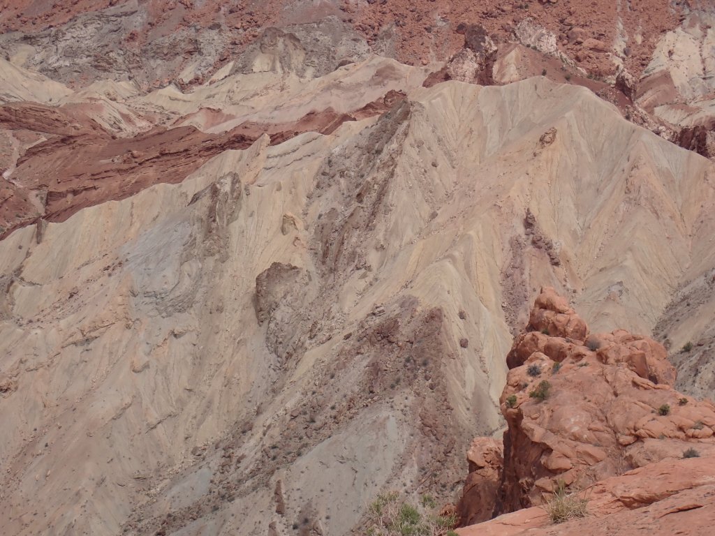
Upheaval Dome- First and Second Overlook:
Upheaval Dome is a bit of a mystery. No one knows the origin of its creation. The rim of the dome is 3 miles wide and 1,000 feet above the floor. Several theories have been proposed: 1) Pinched off Salt Dome or 2) A Complex Meteorite Impact. The salt dome theory suggests that a layer of salt was left after a salt water sea evaporated is gradually squeezed upwards under the weight of surrounding rock. This theory assumes that 20 million years of moderate pressure would be necessary to create the effect vs. a few minutes from a meteor impact. In 2007, Elmar Buchner and Thomas Kenkmann, German Scientists, found quartz crystals that were “shocked” by the high powered meteor impact. Many now consider the mystery closed- meteor impact!
Directions- Pass the Visitor Center, continue up the road and follow signs to the right for Upheaval Dome. Parking lot is a good size. Picnic areas and outhouse facilities available. No drinking water.


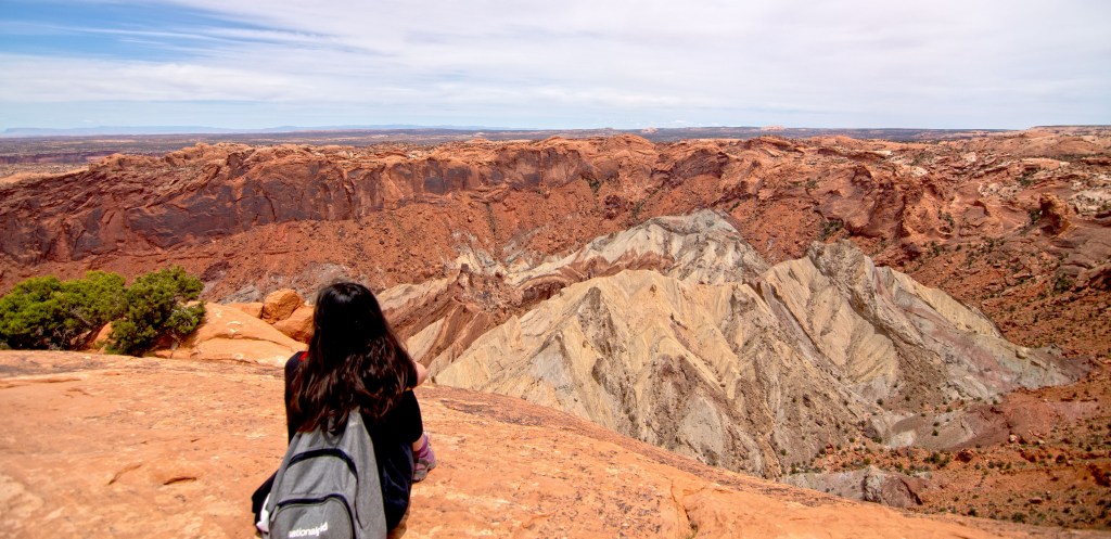

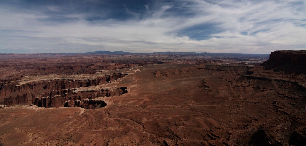
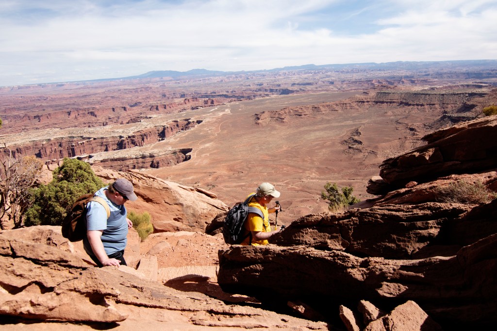
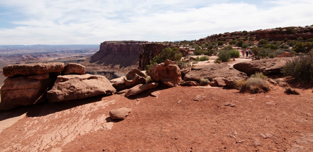
Grand View Point:
Provides a wonderful overlook of Canyonlands. You can wander along the trail which borders the canyon rim (please watch your footing, especially when taking selfies- there are NO RAILINGS!)


ancient publeon Casa Riconda Chacoan Great Houses Chaco Culture National Historical Park cliff palace Hugo Pavi isla mujeres Junior Park Ranger program Kivas long house mesa verde Mesa Verde audio tour mug house National Park North Beach petroglyphs Petroglyph trail Pueblo Bonito Pueblo del Arroyo Recreation.gov reviews Square House Tower Supernova tour ultramar Una Vida Wetherill mesa whale shark snorkel
