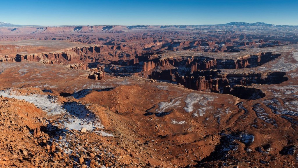
Canyonlands National Park is another installation in Utah’s gallery of geological magnum opuses.
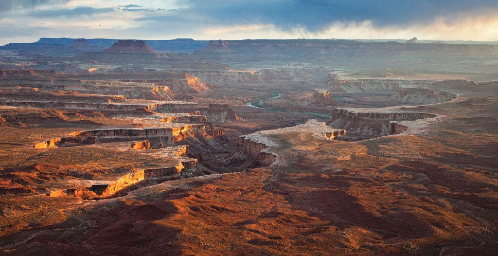
With layers upon layers of exposed sediment, Canyonlands is a diagram from nature itself – courtesy of Discover Moab
Table of Contents
- Table of Contents
- Nature Dig, Dig, Dig, Dig, Dig, Dig, Digs In The Earth The Whole Way Through
- First Witnesses
- Ghost Ri- er, Island in the Sky
- Window to the Depths
- Canyon Critters (Cringe Section Title)
- Plants Matter
- Canyonlands: The National Park (No Official Sequel Heading to Theaters)
- Canyonlands: Need We Say More?
Nature Dig, Dig, Dig, Dig, Dig, Dig, Digs In The Earth The Whole Way Through
Canyonlands’ rock is a cluster of sediments from ranges such as the Rockies and Appalachians (in their more ancient, higher-elevated forms). Wind and water carried the rocks which would eventually be the layers seen in the titular canyons today.
Ironically, the canyons of modern times weren’t always here, even when the sediments were lain. The rock created a “layer cake”, where most of the geologic material was hidden beneath the surface. As far as one could see, there were only gently-rolling plains for some time. 20 million years ago, this began to change. Movements in the Earth’s crust caused landforms such as the Colorado plateau (where Canyonlands is) to take shape. The movements also created cracks wherein molten rock escaped the crust; some of this molten rock cooled before reaching the surface, concocting harder igneous rock in surrounding sedimentary layers.
Layers of the Colorado plateau – courtesy of Earth@Home
As the Colorado plateau rose, sediment-depositing rivers in the lowlands began to remove sediment from the escalating plateau. The Green and Colorado rivers carved into the “layer cake”, exposing buried sediments and assembling Canyonlands in the process. This process was assisted by summer thunderstorms’ deluge. Eventually, soft rock layers were swept away and harder rock layers were exposed; this provided Canyonlands its staircased appearance. Slabs of harder rock occasionally protected weaker rocks beneath, ensuring balanced rocks and towers. Water also seeped into rock cracks, eroding and widening them until only thin spires remained. The spires are nicknamed “The Needles” since they resemble the medical/sewing equipment (although barely).
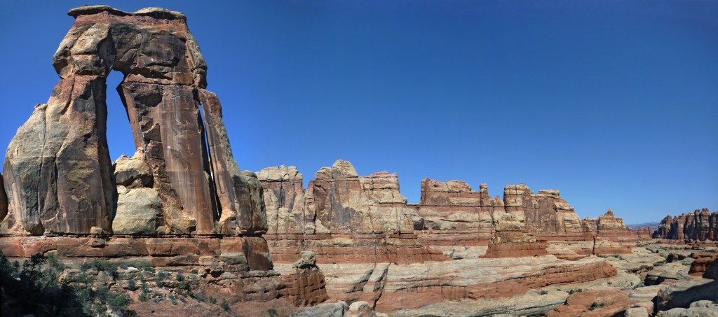
In the background are The Needles – courtesy of The American Southwest

The “Needles” being in clusters makes their resemblance to sewing and acupuncture needles difficult to discern – courtesy of Lierre
First Witnesses
Nomadic hunter-gatherers, between 8,000 B.C. and 500 B.C., were among the first to see Canyonlands. These earliest peoples’ most endearing legacy are their petroglyphs and pictographs, which can be found in the park at sites such as Horseshoe Canyon.
Horseshoe Canyon is molded by the Green river – courtesy of National Geographic

Horseshoe Canyon’s title is rooted in the “U” shape of the metallic footgear of the same name – courtesy of Deep Hollow Ranch
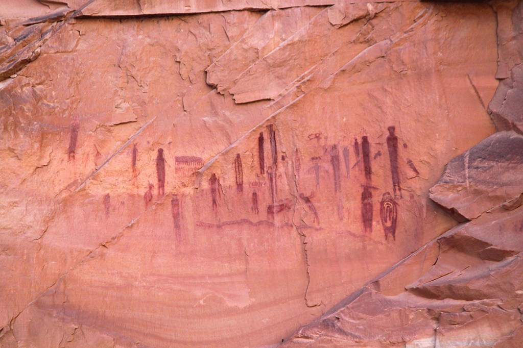
Petroglyphs on Horseshoe Canyon’s walls – courtesy of Capitol Reef Country
Two thousand years ago, trade networks in the region led the hunter-gatherers into a more sedentary life. These were who are now known as the Fremont peoples. Animals were still relied on as a nutritional source, but big game was replaced by smaller game. In turn, wild plants (minus seasonal nuts and seeds) were replaced by grown items such as maize, beans, and squash.
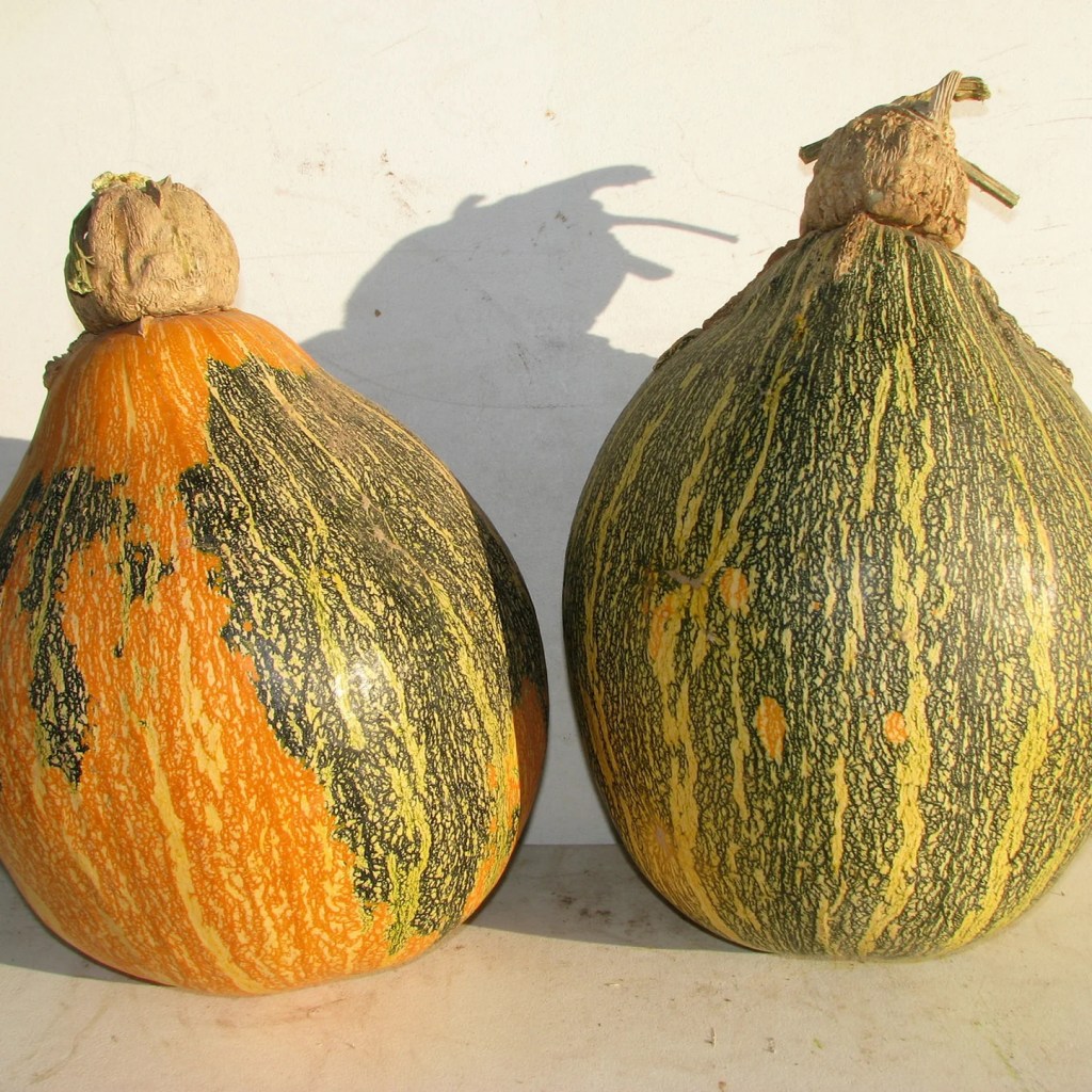
Crops such as squash have long dominated the American Southwest’s agricultural scene – courtesy of Native-Seeds-Search
At the same time the Fremont thrived, the Ancestral Puebloans did so further south. Both peoples’ territories overlapped, and the clan-based villages of each grew into hundreds-strong communities. Circa 1200 A.D., Canyonlands flourished. Artifacts found in Salt Creek Canyon and elsewhere are glimpses of these civilizations’ prosperity.
A surface in Salt Creek Canyon is coated in desert varnish, an organism which (essentially) is to the American Southwest what moss is to northern temperate forests – courtesy of Intermountain Healthcare
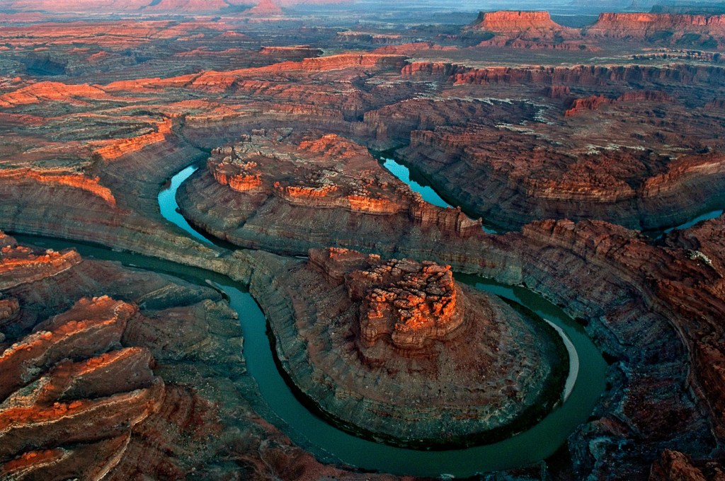
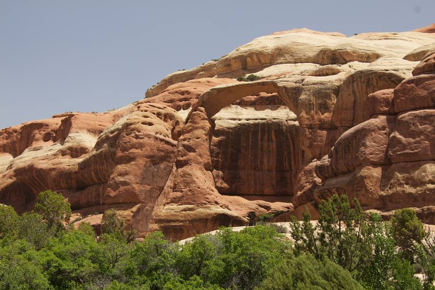
Ghost Ri- er, Island in the Sky
Canyonlands already offers a plethora of pinnacles and descents, given how deep the canyons can go. Island in the Sky rises above even some of the higher spots, specifically 1,000 feet (or 304 meters) above them. Depending on whether you hike or use a four wheel drive vehicle, traversing it can take hours to days.

Island in the Sky couldn’t be a more appropriate name for this formation; not only do the canyons suggest water could fill to the near-brim of the mesas, actual islands were near here during the Western Interior Seaway’s existence – courtesy of Lonely Planet
Window to the Depths
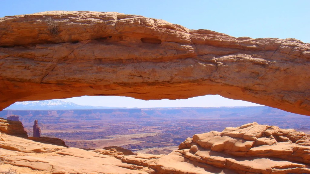
Courtesy of Your Hike Guide
When it comes to Canyonlands (or any natural splendors), framing of the formations and flora (and sometimes fauna) is what sells the experience for visitors (and residents). Mesa Arch is arguably Canyonlands’ embodiment of said framing. 27 feet (or 8.3 meters) in length, the arch is known for how it frames the canyon below it with the snowcapped La Sal mountains in the distance. The arch is a popular site for sunrise photography, as the sunrise’s glow from the bottom of the arch is magnificent.
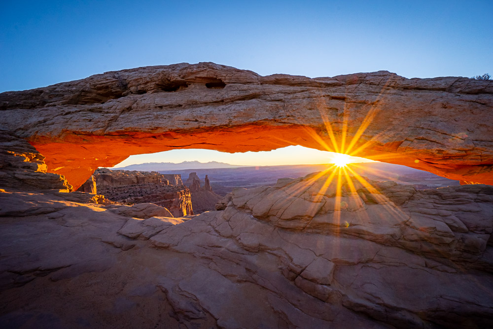
Of course, nothing beats witnessing the sunrise for yourself … though be prepared for plenty of company – courtesy of Fox in the Forest
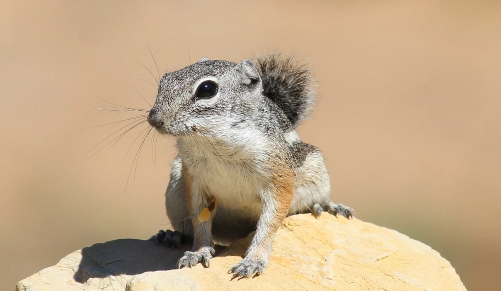
Canyon Critters (Cringe Section Title)
Kangaroo rats, mountain lions, mule deer, porcupines, black-tailed jackrabbits, antelope squirrels … the list goes on.
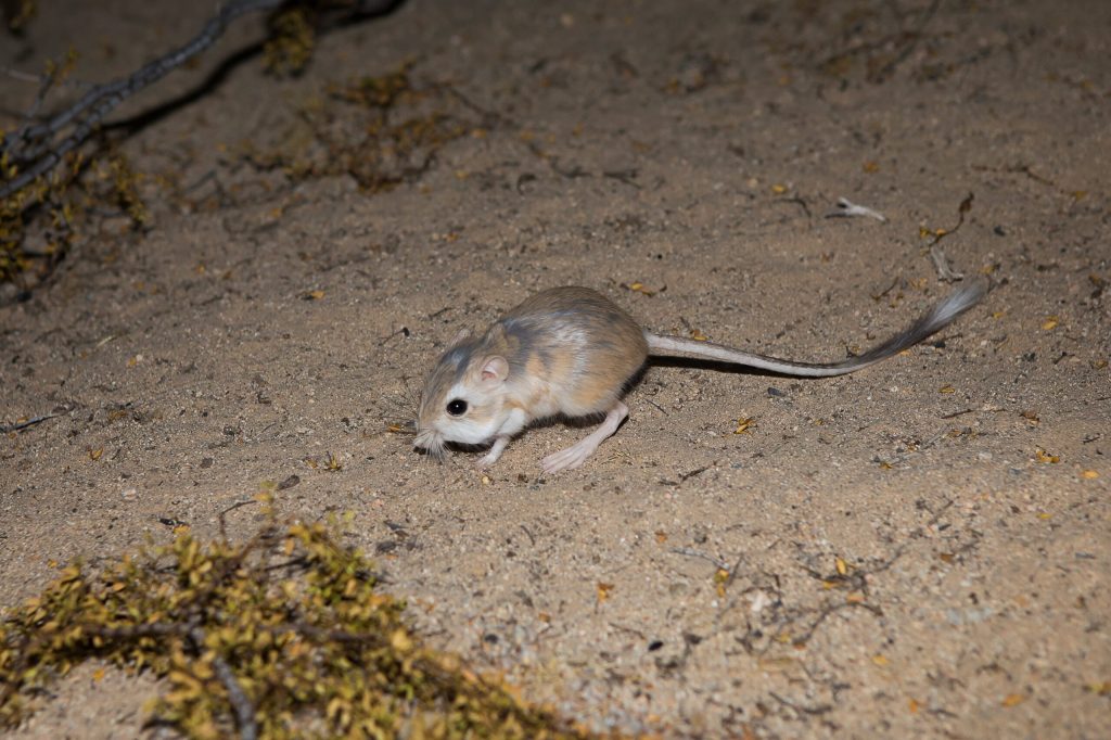
Kangaroo rats were named after their long tails’ resemblance to those of kangaroos – courtesy of Nevada Departement of Wildlife
The Kangaroo rats’ name is given further credence by how their hind legs – akin to actual kangaroos (one pictured) – are larger than their front legs; this helps both bound relatively long distances; coincidentally, both of these live in drier environments (the rats the American Southwest, the “true” kangaroos in Australia); then again, given the scarcity, and distance, between food and water sources in these places, this is amply justified – courtesy of Lincoln Park Zoo
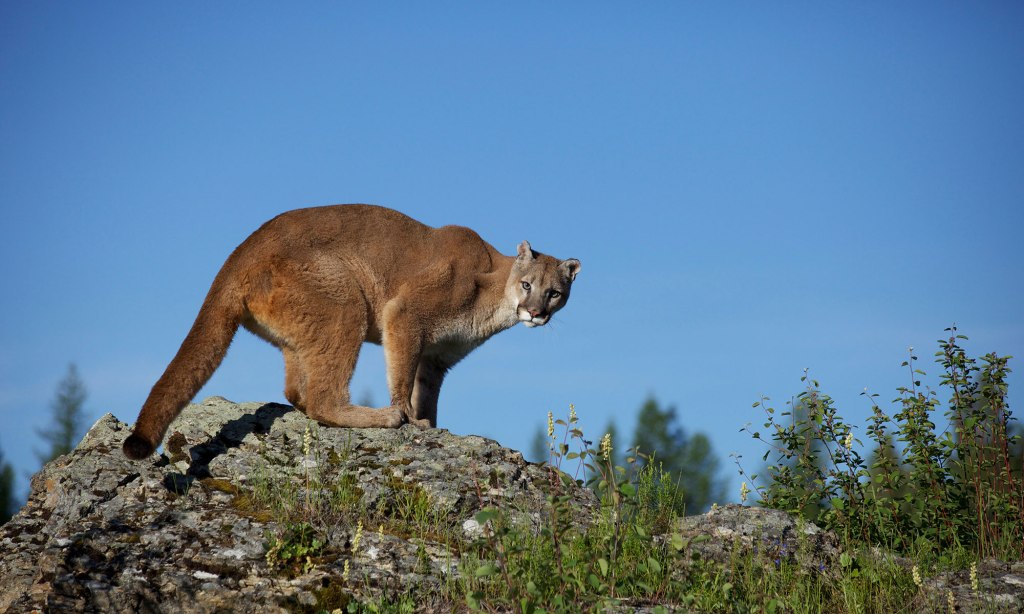
You don’t want a mountain lion looking in your direction – courtesy of The Human Society of the United States

The mountain lion, per its name, lives at higher elevations; the African lion, which the mountain lion is distantly related to, instead roams savannahs in countries such as Kenya and Tanzania – courtesy of Smithsonian’s National Zoo
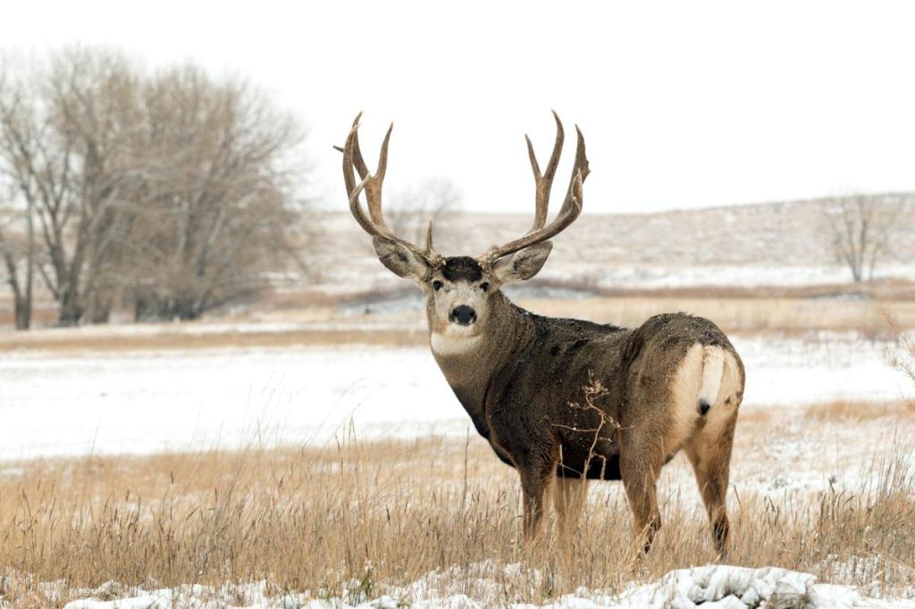
Mule deer may seem harmless against mountain lions, but never let your guard down; these can charge and severely injure you, notably by ramming into you with their muscle mass or being deviously crafty with their horns’ spiked edges – courtesy of Cody Enterprise
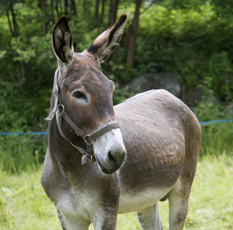
Mule deer are similar to “true” mules in coloration, herbivorous diet, and being quadrupeds, but are otherwise worlds apart in terms of nature; mule deer are untamed animals while “true” mules are domesticated – courtesy of All Things Nature
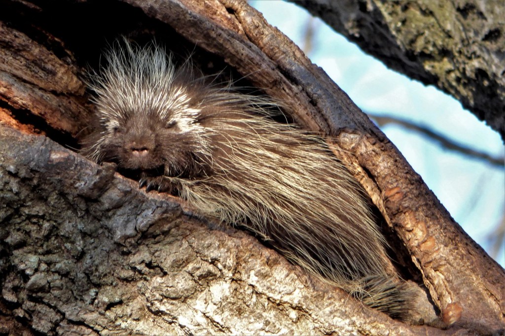
This porcupine is the embodiment of a good night’s sleep – courtesy of Mackinac State Historic Parks
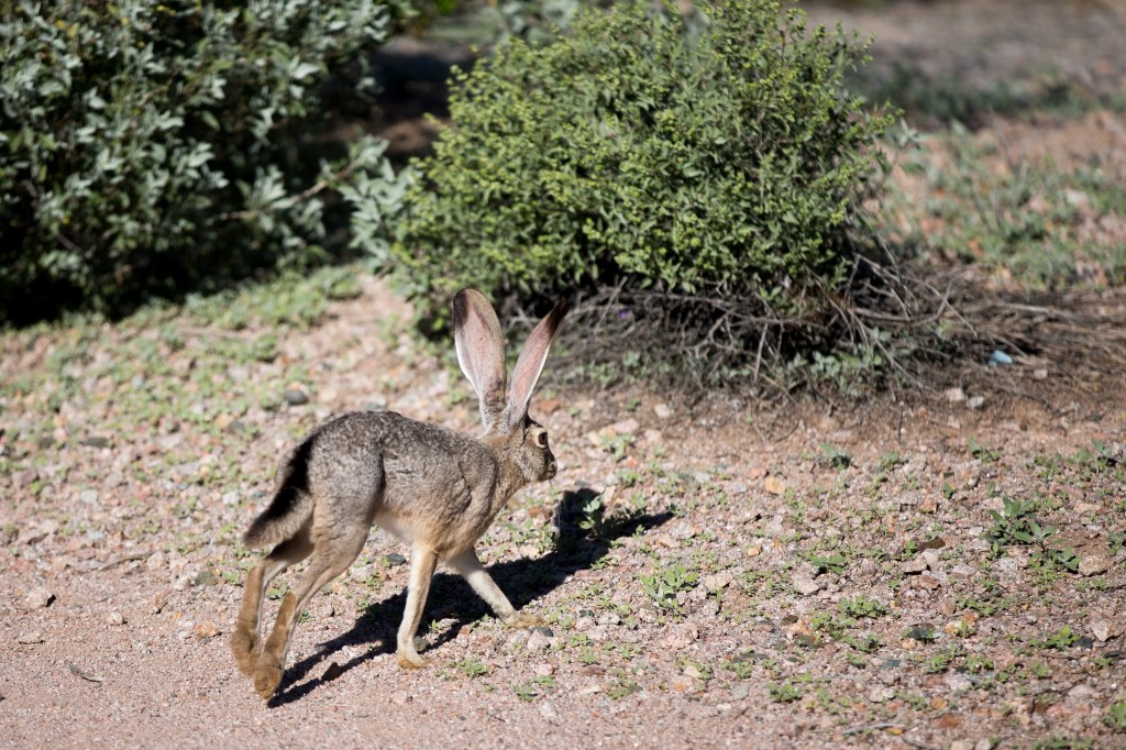
Black-tailed jackrabbits: origin of name need be no more obvious – courtesy of The Desert Sun
Antelope squirrels were named for their vague coloration and appearance similarities to “true” antelopes – courtesy of GoSanAngelo

We said “vague” – this picture should serve as to why – courtesy of African Travel Canvas
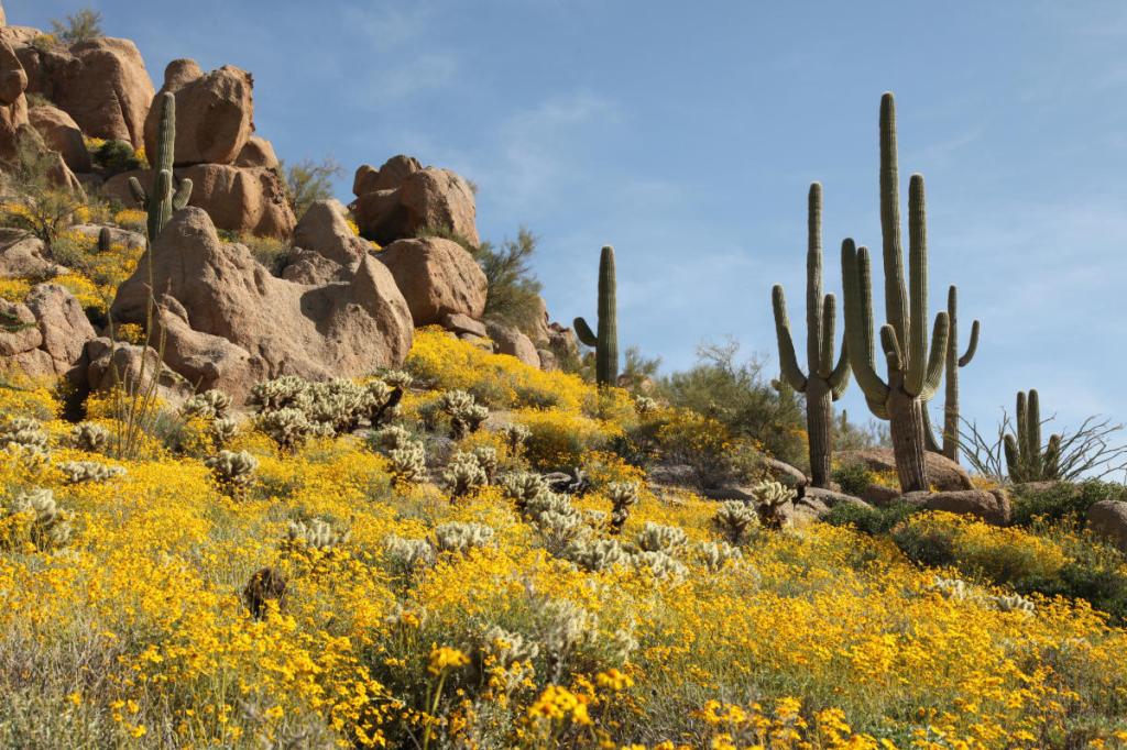
Plants Matter
No ecological system would be complete without wild veggies, and Canyonlands is no outlier. The plants here are grouped into three categories: drought escapers, drought resistors, and drought evaders.
Drought escapers make use of favorable growing conditions when they exist, often when enough water is available. Seeds can lie in the ground and produce nothing for years, depending on how little rainfall/groundwater there is.
Desert wildflowers are drought escapers – courtesy of Visit Phoenix
Drought resistors often have small, spiny leaves that resist the effects of solar radiation and can drop if not enough water is present. Spines and hairy leaves reduce both solar radiation exposure and air current effects, limiting water lost via evaporation.
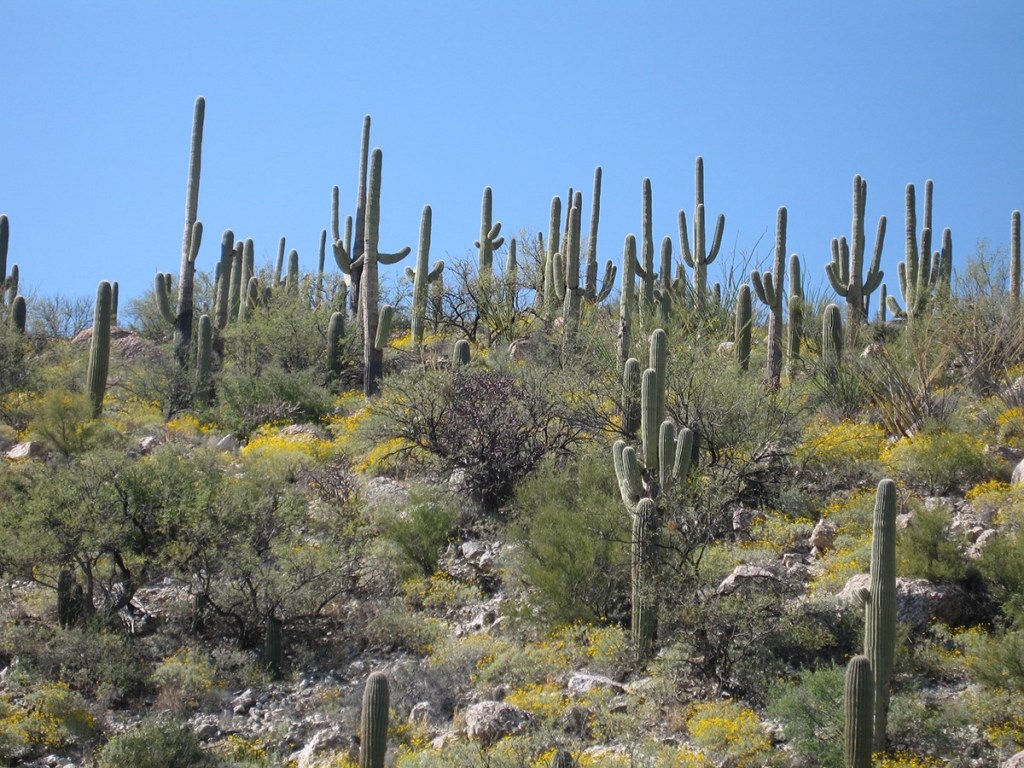
Cacti are drought resistors – courtesy of National Park Service
Drought evaders, unlike the other two plant types in Canyonlands, survive where water is plentiful. Alcoves near seeps or springs, plus river corridors and intermittent streams, are where these sorts of plants are found. As you can imagine, these are slightly rarer than the other plant types due to water shortages here.

Monkey flower is a drought evader – courtesy of Northwest Meadowscapes
Canyonlands: The National Park (No Official Sequel Heading to Theaters)
In the 1930s and 1940s, U.S. organizations took interest in Canyonlands. A national monument was proposed, but was criticized by developers and other business entities since it got in the way of their plans. In the 1950s, opinions of a recreation area here changed when Arches National Monument superintendent Bates Wilson advocated for the creation of a new national park encompassing the view from Grand View Point at Island in the Sky.
Grand View Point – courtesy of National Park Service
Wilson provided government officials tours of the land, and this provided incentive for Secretary of the Interior Stuart Udall (among others) to send these plans further up the governmental ladder. On September 12, 1964, President Lyndon B. Johnson signed Public Law 88-590, establishing 257,640 acres as Canyonlands National Park. The park reached its present size by 1971.
Canyonlands: Need We Say More?
Ok, a tiny bit more. Chiseled by nature, inhabited by the Americas’ earliest peoples, lived in by animals and plants with adaptations to its semi-barren landscape, and set aside as a protected parcel. Want more? Visit!
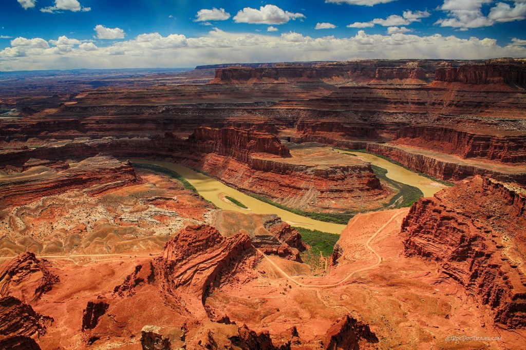
Courtesy of Roc Doc Travel
Sources:
- “Geology”. National Park Service. 1 August 2019 (Updated). https://www.nps.gov/cany/learn/nature/geologicformations.htm
- “American Indians”. National Park Service. 8 April 2022 (Updated). https://www.nps.gov/cany/learn/historyculture/nativeamericans.htm
- “Island in the Sky”. National Park Service. 31 January 2023 (Updated). https://www.nps.gov/cany/planyourvisit/islandinthesky.htm
- “Mesa Arch Trail”. National Park Service. 31 January 2023 (Updated). https://www.nps.gov/places/mesa-arch.htm
- “Animals”. National Park Service. 14 February 2019 (Updated). https://www.nps.gov/cany/learn/nature/animals.htm#:~:text=Crepuscular%20animals%20include%20mule%20deer,snakes%2C%20hawks%2C%20and%20eagles.
- “Plants”. National Park Service. 2 February 2018 (Updated). https://www.nps.gov/cany/learn/nature/plants.htm
- “Park Founders”. National Park Service. 20 November 2020 (Updated). https://www.nps.gov/cany/learn/historyculture/parkfounders.htm#:~:text=On%20September%2012%2C%201964%2C%20President,not%20included%20and%20remains%20unprotected.
ancient publeon Casa Riconda Chacoan Great Houses Chaco Culture National Historical Park cliff palace Hugo Pavi isla mujeres Junior Park Ranger program Kivas long house mesa verde Mesa Verde audio tour mug house National Park North Beach petroglyphs Petroglyph trail Pueblo Bonito Pueblo del Arroyo Recreation.gov reviews Square House Tower Supernova tour ultramar Una Vida Wetherill mesa whale shark snorkel
