NOTICE: THIS IS A HIGH ALTITUDE ATTRACTION. PEOPLE USED TO LIVING IN LOWLAND AREAS SHOULD BE AWARE OF AND PREPARED FOR POTENTIAL BREATHING AND EXHAUSTION ISSUES.
Utah’s First National Park!
Address: Lake Powell, UT 84533 Hours: Open 24 hours Phone: (435) 692-1234
Established: April 15, 1908
Visitors- More than 100,000 per year.
“In wilderness is the preservation of the world.”
-Henry David Thoreau
Natural Bridges National Monument was formed in 1908 by President Theodore Roosevelt after it was featured in a 1904 National Geographic article. It is famous for its three geological bridge formations.

Table of Contents
- Table of Contents
- Need To Know:
- Please Practice Leave NO Trace!
- Let’s Tour!
- Congratulations- you have successfully toured Natural Bridges National Monument!
Need To Know:
Natural Bridges is a 9 mile, paved, one way loop on Bridge View Drive that leads to scenic overlooks and trailheads. The drive is flat with views of high desert scenery. All three bridges can be viewed from above with short walks from the parking lots. It is possible to get closer to the formation by completing the hike to each bridge. There is also a hiking trail that circles the park and takes you to each bridge, as well as Ancient Puebloan ruins and petroglyphs.
ADMISSIONS: Shortly after crossing into the park you will encounter the park admission entrance. The monument is covered under the America The Beautiful pass. If you don’t have the pass- admission will cost as of January 2023 https://www.nps.gov/nabr/planyourvisit/basicinfo.htm:
Private Vehicle – $20.00
Admits one private, non-commercial vehicle (15 passenger capacity or less) and its occupants.
Motorcycle – $15.00
Admits a private, non-commercial motorcycle and its riders.
Per Person – $10.00
Admits one individual with no car. This pass is typically used for bicyclists, and pedestrians. Youth 15 and under are admitted free.
CELL PHONE COVERAGE– there is no cell phone coverage.
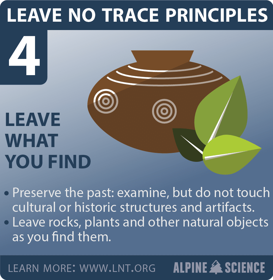
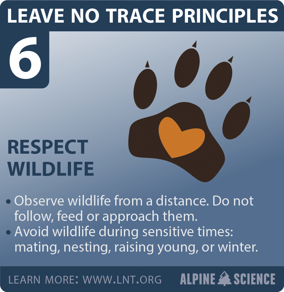
Please Practice Leave NO Trace!


FOOD and DRINK– There are no nearby restaurants, or grocery stores- so plan accordingly. It is at least 45 min from the park exit to the nearest eatery in Blanding, Utah. The souvenir shop does offer bottled water and snacks. Remember, when hiking- it is essential that you carry at least 2 liters of water/person at a minimum. Altitude is very dehydrating and often catches a person by surprise- so drink! There is a water bottle fill station inside the Visitor Center as well as an outdoor spigot for obtaining water. Picnic tables are available. Most restaurants are CLOSED on SUNDAYS in Utah- you can still find fast food- primarily at gas stations- such as Subway. So plan ahead if you are traveling on a Sunday!
GAS- No nearby gas stations- so make sure you have adequate fuel.
BATHROOMS– can be found at the Visitor’s Center
LODGING/CAMPING– There is no park lodge/hotel, but camping is available near the Visitor Center (approximately 1/4 mile away) on a first come/first served. For information see https://www.nps.gov/nabr/planyourvisit/eatingsleeping.htm
PROGRAMS– are offered by Park Rangers. Natural Bridges is a Dark Skies certified park so stargazing is phenomenal. Check the website for schedule at https://www.nps.gov/nabr/planyourvisit/calendar.htm

Let’s Tour!
Visitor’s Center is the place to begin. A chance to talk with the park rangers and learn about events, check on trail conditions, weather, and get suggestions on how to plan your trip. Most people spend an average to 2-3 hours at the park. It is also your chance to check out the souvenirs and the all important rest rooms! Remember- the loop is ONE WAY- so once you start- you must complete the 9 mile drive to exit.
A WORD ON HIKING– hiking to every bridge may not be for everyone- so if you have to pick one bridge to see up close- it is recommended that you choose Owachomo, the final bridge on the tour which can be accessed by an easy half mile hike. Additional trail maps, reviews and information can be found at All Trails https://www.alltrails.com/parks/us/utah/natural-bridges-national-monumentCo
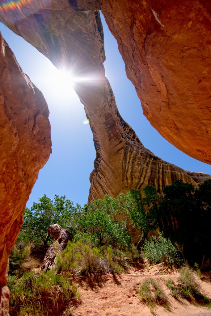
STOP ONE: SIPAPU BRIDGE: will be the first bridge encountered on the drive. There are several scenic outlooks. From the parking lot, it is just a short walk to the overlook. If you wish to descend to the bridge- the trailhead is rated moderate and crosses over mesa sandstone and the use of metal ladders bolted to the rock are a necessity to descend. Hiking time ranges between 1-2 hours.


Photographs Courtesy of Kim Meehan
Sipapu Bridge was originally known as “Augusta” and later as “President” before the restoration of its Hopi name-Sipapu- meaning the “Place of Emergence” or “the opening between worlds”. The bridge is the 13th longest natural bridge in the world, and the widest span of any bridge in the park. In terms of age- it falls in the middle of the three bridges within the park with Owachomo being the oldest and the youngest Kachina.
| Rank | Image | Name | Location | Span |
| 1 | Fairy Bridge | Buliu River, Guangxi, China | 400 ft | |
| 2 | Zhijin Natural Bridge | Zhijin Cave Scenic Area, Guizhou, China | 340 ft | |
| 3? | Jiangzhou Immortal Bridge | Jiangzhou, Guangxi, China | 280- 340 ft | |
| 4 | Dachuandong Arch | Guizhou Province, China | 300 ft | |
| 5 | Landscape Arch | Arches National Park, Utah | 290 ft | |
| 6 | Kolob Arch | Zion National Park, Utah | 287 ft | |
| 7 | Qingxudong Arch | Guizhou Province, China | 251 ft | |
| 8 | Aloba Arch | Ennedi Range, Chad (Sahara Desert) | 250 ft | |
| 9 | Morning Glory Natural Bridge | Moab, Utah | 243 ft | |
| 10 | Gaotun Natural Bridge | Bazhou He Scenic Area, Guizhou, China | 240 ft | |
| 11 | Rainbow Bridge | Rainbow Bridge National Monument, Utah | 234 ft | |
| 12 | Great Arch of Getu | Getu Valley National Park, Guangxi, China | 230 ft | |
| 13 | Sipapu Natural Bridge | Natural Bridges National Monument, Utah | 225 ft | |
| 14 | Stevens Arch | Escalante River, Utah | 220 ft | |
| 15 | Shiptons Arch (Tushuk Tash) | Near Kashgar, Xinjiang, China | 214 ft | |
| 16 | Yunmentum Bridge | Near Zunyi, Guizhou, China | 213 ft | |
| 17 | Hazarchishma Natural Bridge | Bamyan Province, Afghanistan | 211 ft | |
| 18 | Outlaw Arch | Dinosaur National Monument, Colorado | 206 ft | |
| 19 | Snake Bridge | Sanostee, New Mexico | 204 ft |
According to the National Park Service the bridge has:
Span: 268 feet (82 meters) Width: 31 feet (9.5 meters) Thickness: 53 feet (16 meters)


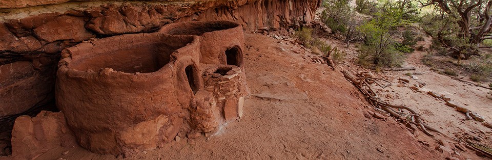
STOP TWO: HORSE COLLAR RUIN OVERLOOK: From the parking lot take the 0.3 of a mile unpaved trail to the overlook. The Ancient Pueblo ruins are situated on the other side of the canyon- so binoculars assist in getting a decent view. If you take the hiking trail between Sipapu and Kachina- it will pass these ruins. The ruins received their name from the horseshoe like doorways located on two of the structures. These ruins are important to modern day Puebloan people– so please treat them with great respect- do not litter, eat, or deface. Do not eat near the ruins to prevent attracting rodents. Do not enter the structures. Take nothing from the sight- but photos.
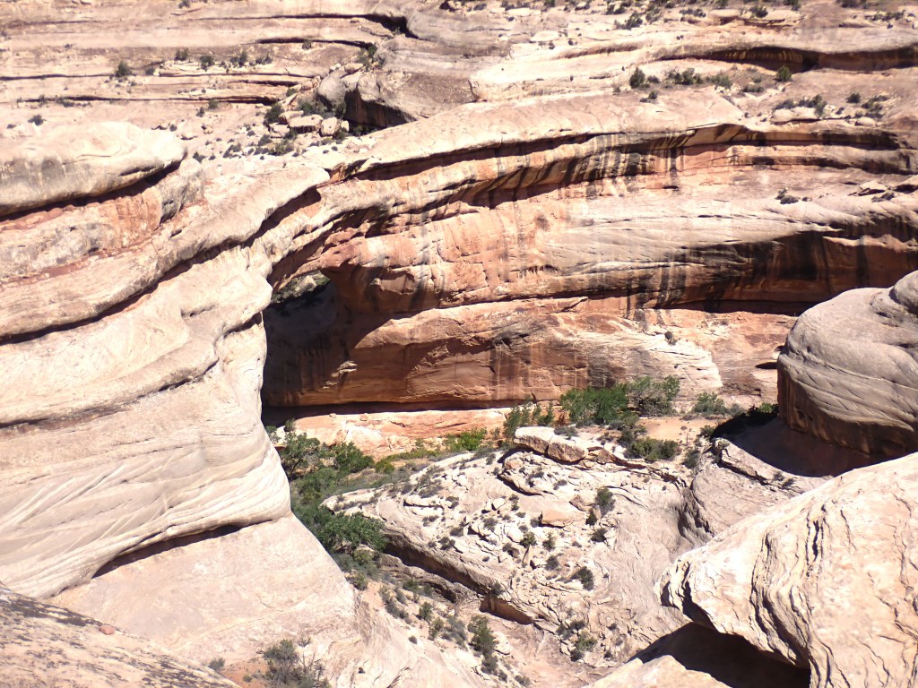
STOP THREE: KACHINA BRIDGE is in the middle and qualifies as the youngest and thickest. It formerly held the names of “Caroline” and later “Senator”. Kachina, in the Hopi language, means “Ghost Dancer” because of the dancing petroglyphs carved into the rockface of the bridge. The bridge is still undergoing transformation- in 1992, 4,000 tons of sandstone fell from the interior leading to a wider opening. The National Park System gives the bridge the following dimensions: Height: 210 feet (64 meters) Span: 204 feet (62 meters) Width: 44 feet (13 meters) Thickness: 93 feet (28 meters)
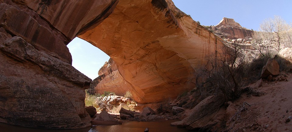
The Kachina Bridge Overlook is roughly at mile 4.5. It is a 10 min hike ( 0.3 miles)on a paved trail to the overlook. The bridge spans Armstrong Canyon, a tributary of White Canyon. If you wish to hike down to the bridge- you will find the trailhead entrance at the Kachina Bridge parking lot. Plan on 1-2 hours to complete the 1.7 mile journey rate as STRENOUS with steep stairs, handrails and wooden ladders.
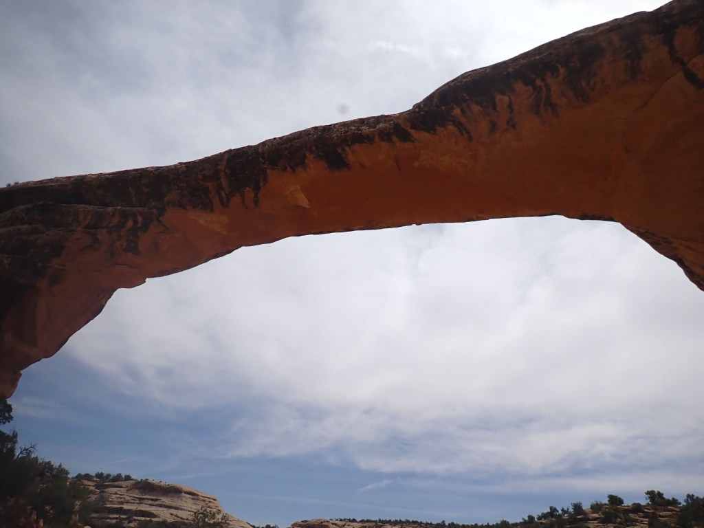
STOP FOUR: OWACHOMA BRIDGE– has the distinction of being the shortest, thinnest and probably oldest of all the parks. Age can be difficult to determine as the rate of erosion for each bridge is different. Originally named “Edwin” followed by “Congressman” before receiving its Hopi name “Owachomo” meaning “rock mound” The National Park Service measures the bridge at: Height: 106 feet (32 meters) Span: 180 feet (55 meters) Width: 27 feet (8 meters) Thickness: 9 feet (3 meters)


Photos Courtesy of: Kim Meehan
Owachomo Lookout is about a 10 minute walk from the Owachomo Parking Lot and is accessible to all. The hike to Owachomo is the easiest of all three bridges. So if you only have time or hiking desire for one- this is the bridge that most people choose. The bridge is a 0.5 mile roundtrip trail with a descending change in elevation of 188 feet.
Congratulations- you have successfully toured Natural Bridges National Monument!
ancient publeon Casa Riconda Chacoan Great Houses Chaco Culture National Historical Park cliff palace Hugo Pavi isla mujeres Junior Park Ranger program Kivas long house mesa verde Mesa Verde audio tour mug house National Park North Beach petroglyphs Petroglyph trail Pueblo Bonito Pueblo del Arroyo Recreation.gov reviews Square House Tower Supernova tour ultramar Una Vida Wetherill mesa whale shark snorkel
