- North Rim Natural Geology
- Native Americans of the North Rim (Plus Encroachers)
- Filled to the Rim
- North, South, East, or West, anybody can see the North Rim
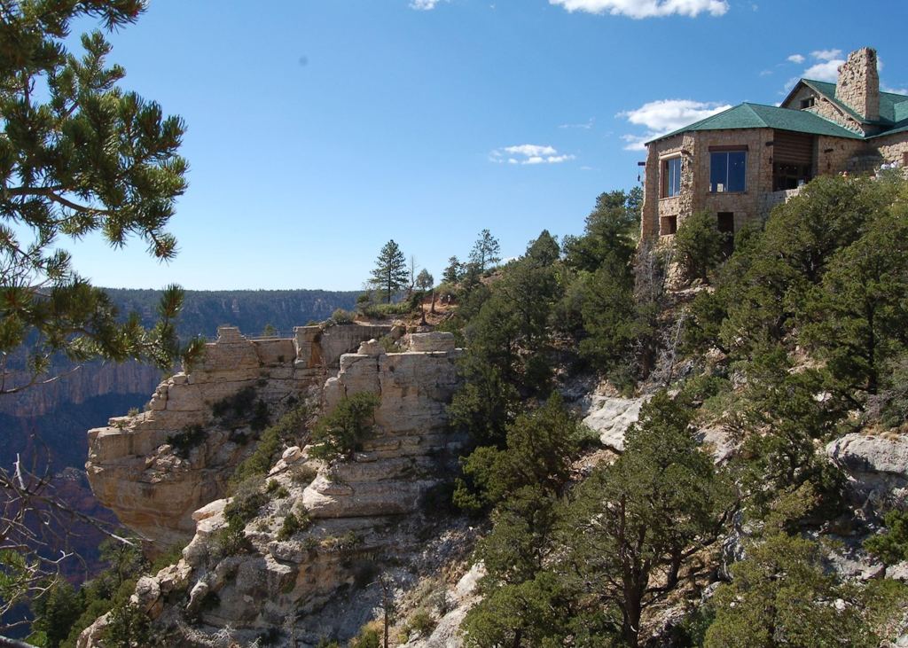
Courtesy of Audley Travel
North Rim Natural Geology
On average, the Grand Canyon is ten miles across and one mile deep, a consequence of tectonic uplift of the Colorado Plateau and erosion from the Colorado River (plus freezing, thawing (see Goblins National Park and Bryce Canyon pages for more on that), and wind). The canyon was originally envisioned as a gradual, one-trip-through formation, but recent findings point towards it being a collage of several smaller, older rivers and canyons absorbing each other into a giant river and canyon over time.

Stone layers in the Colorado Plateau and the Grand Canyon; the diagram doesn’t show the North Rim is higher than the South Rim – courtesy of The University of Rhode Island
The slight dip of the Colorado Plateau means the GC’s North Rim is 1,200 feet (365 meters) taller than the South Rim.

The Kaibab Limestone is the tallest the GC’s South Rim goes, while the North Rim has supplementary layers Moenkopi Formation and San Francisco Volcanic Fields – courtesy of VIVA Open Publishing
Native Americans of the North Rim (Plus Encroachers)
The Grand Canyon was a nexus of Native American activity beginning 10,000 years ago. In 200 B.C., Ancestral Puebloans migrated to the canyon. APs left behind works such as the Anasazi Granary.
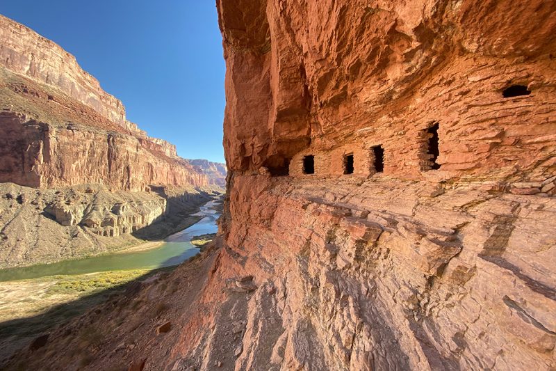
Anasazi Granary – courtesy of GoRafting
By 1110 A.D., the Ancestral Puebloans’ societies collapsed. In their place, other tribes migrated to the inner canyon and upper plateau to live there year round. In the mid-1800s, whites moved west en masse and fought local peoples. Genocide upon genocide, forced relocation upon forced relocation, were wrought by the U.S. government and their backers. Eurocentric settlements appeared, and mining operations were set for gold, silver, copper, zinc, asbestos, and uranium.
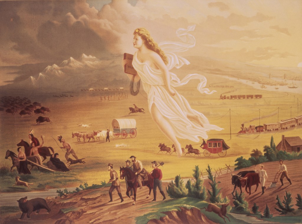
Propagandic painting for Manifest Destiny, the idea that white Americans had a “religious duty” to conquer North America from east coast to west coast; “civilized” whites in the picture have “blessings of civilization” such as carriages, railroads, and European-style farming, while “savage” Native Americans have crude tools and close ties to nature; the “bringer of change” is personified as a chalky-skinned blonde – courtesy of Newsweek
The U.S. government made treaties which benefitted both sides in theory but in practice disadvantaged Native Americans (similar to agreements between First Nations and white Canadians). Out of 374 treaties, 229 of them forced indigenous nations to surrender tribal lands while 99 treaties promised reservations in exchange. In the U.S. today, there are 327 reservations and 600 federally recognized tribes (22 of them in Arizona). There are innumerable other tribes recognized at state level, but not national level.
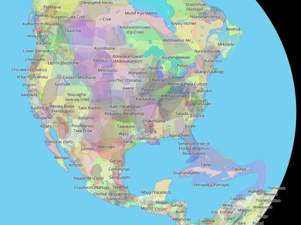
Pre-European Contact map of Native American tribes; the Inuit, the northernmost of the Native Americans, are designated as separate from other indigenous Canadians (First Nations) for historic, cultural, and legal reasons; the Michif Piyii (Metis) are part of the Metis mixed race ethnicity (commonly, but not restricted to, French-Cree descent) and are, like the Inuit, classified separate from First Nations; the Apalachees of northern Florida had their name contrivedly applied to the Appalachian mountains; the Maya are listed as Yucateco since their division inhabits the Yucatan peninsula, complete with their own dialect of Maya (distinct from highland tongues of Guatemala); the Taino are the peoples Christopher Columbus and crew encountered and committed atrocities against, making their case the precursor of genocides across the continent (though one could say the Norse Leif Eriksson and crew did the same to First Nations of the northeast centuries before) – courtesy of NPR
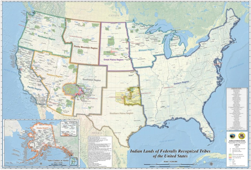
Native American tribes (and associated reservations) recognized by the U.S. government nationally; the giant green area in northeast Arizona, southeast Utah, and northwest New Mexico is the Navajo Nation, or Naabeeho Binahasdzo; its sprawling territory has patches within which belong to other tribes – courtesy of Wikimedia Commons
Serious change only began to happen in the 1970s. In the wake of the Civil Rights Movement, the federal government introduced policies supportive of tribal self-determination. In 1975, the Grand Canyon Enlargement Act transferred many lands back into tribal hands. By the 1990s, tribal assessments influenced park management decisions.
Some tribes and members have voiced concern over the tourist industry’s impact on the canyon. Trevor Reed, a Hopi associate professor of law at ASU’s Sandra Day O’Connor College of Law, says, “[The Grand Canyon] … holds the ruins, the shrines, the petroglyphs and the markings of our tribes and others. It’s a remarkable place, and the Escalade project was so off-putting for many reasons”. The Grand Canyon Escalade, as we covered in our primary GC page, was a proposed route which would’ve made the canyon more reachable to a wider number of people; the project was vanquished per the Navajo Nation’s concerns as to its impact on the environment.
Some tribal leaders and members prioritize the financial security of the tribe first, leading to some tribes’ establishment/approval of tourist (and/or other) revenue sources. Ex.: the Hualapai gain monetary benefits from businesses such as the famed Grand Canyon Skywalk.

Grand Canyon Skywalk isn’t for the acrophobic – courtesy of BNO News
Filled to the Rim
Before we continue, yes, one of our authors enjoys explaining what he’s learned in college and elsewhere, if you haven’t figured out by the many side tangents in our history pages.
Anyway, more on the North Rim itself.
Only 12% of the GC’s millions of visitors per year visit the North Rim. It has to do with the North’s comparative lack of advertising and that its location is a five hour, 212 mile drive from the South Rim.

Courtesy of National Park Maps
The North Rim has mixed conifer forest with aspen. Cooler temperatures and freezing nights happen as late as May and as early as September.

Mixed conifer forest of the North Rim; the trees in the foreground are Ponderosa pine – courtesy of USGS

Aspen trees at North Rim’s lodges in Fall – courtesy of National Park Service
Bald eagles, elk, Western Pipistrelle Bats, and other creatures are canyon tenants (minus paying rent).
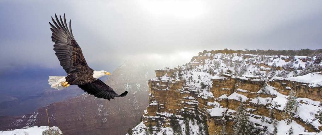
Bald eagle glides through the clouds o’er the North Rim – courtesy of Grand Canyon Visitor Center

Elk at the North Rim – courtesy of Grand Canyon National Park Trips

Western Pipistrelle Bat, a.k.a. Canyon Bat – courtesy of Grand Canyon National Park Trips
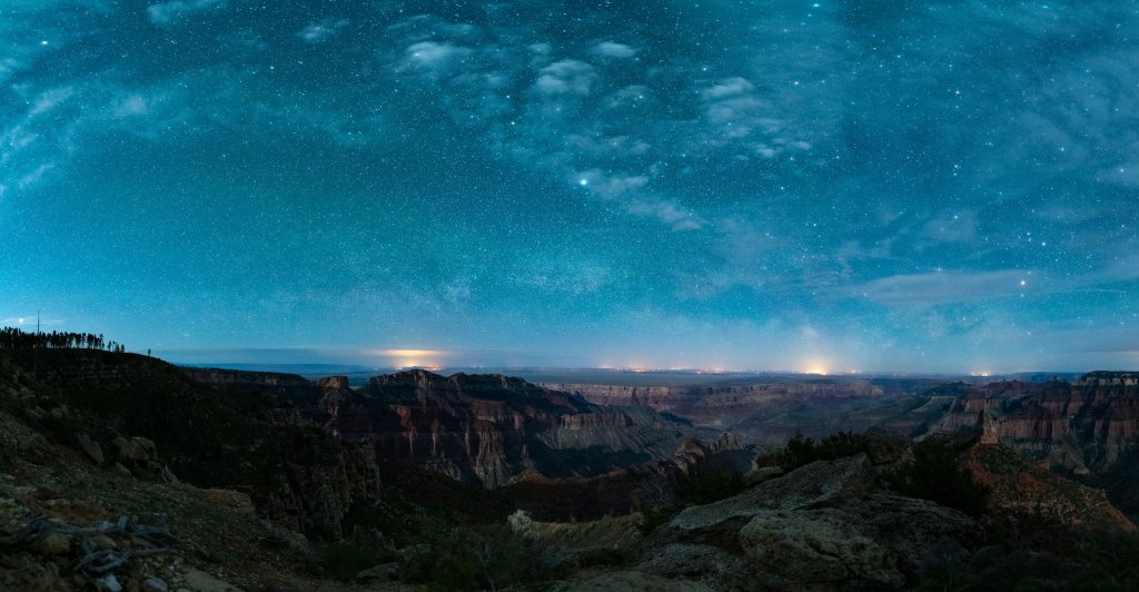
North, South, East, or West, anybody can see the North Rim
Courtesy of National Parks at Night
Sources:
- Haldeman, Morgan and Reisman, Mikaela. “Geology of the Colorado Plateau: Grand Canyon National Park”. The University of Rhode Island. https://web.uri.edu/geofieldtrip/grand-canyon-national-park/
- Terrill, Marshall. “Native American view of the Grand Canyon’s centennial celebration”. Arizona State University. 25 February 2019. https://news.asu.edu/20190211-discoveries-how-native-americans-view-grand-canyons-centennial-celebration
- Peglar, Tori. “Grand Canyon North Rim”. My Grand Canyon Park. 10 April 2023. https://www.mygrandcanyonpark.com/park/places/grand-canyon-north-rim/
- “Wildlife”. My Grand Canyon Park. https://www.mygrandcanyonpark.com/things-to-do/wildlife/
ancient publeon Casa Riconda Chacoan Great Houses Chaco Culture National Historical Park cliff palace Hugo Pavi isla mujeres Junior Park Ranger program Kivas long house mesa verde Mesa Verde audio tour mug house National Park North Beach petroglyphs Petroglyph trail Pueblo Bonito Pueblo del Arroyo Recreation.gov reviews Square House Tower Supernova tour ultramar Una Vida Wetherill mesa whale shark snorkel
