Arches is located in southeastern Utah, approximately 5 miles from Moab on US 191
“Mother Nature is a master sculptor and in no place is that more evident than at Arches National Park.”
― Stefanie Payne
NOTICE: THIS IS A HIGH ALTITUDE ATTRACTION. PEOPLE USED TO LIVING IN LOWLAND AREAS SHOULD BE AWARE OF AND PREPARED FOR POTENTIAL BREATHING AND EXHAUSTION ISSUES.
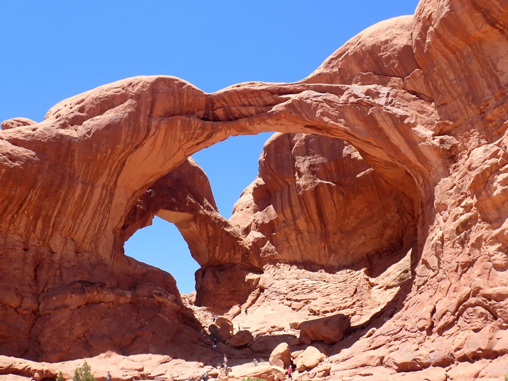
Table of Contents
- Table of Contents
- Demographics:
- The Timed Entry–https://www.recreation.gov/timed-entry/10088426/ticket/10088427
- Timed Entry Ticket Purchase:
- Rules:
- Driving Directions:
- Admissions Gate:
- Please Practice- Leave No Trace
- Packing Your Hiking Daypack
- Let’s Go Tour
- Visitor Center:
- Parking Lot Capacity:
- Devils Garden Parking Lot
- The Windows Section Parking Lot
- Wolfe Ranch Parking Lot
- Drive Times From Visitor’s Center
- Map of Arches National Park
- Go to the Rear of the Park and Work Forward:
- Devil’s Garden:
- Tunnel Arch
- Pine Tree Arch-
- Landscape Arch
- Navajo Arch/ Partition Arch:
- Double O Arch/ Dark Angel Arch:
- Park Avenue
- Balanced Rock:
- Delicate Arch:
- WINDOWS and TURRETS:
- Double Arch:
- Parade of Elephants:
- North and South Windows “the Spectacles”:
- Turret Arch:
- Garden of Eden:
- Tower Arch:
- Sand Dune Arch/ Broken Arch/ Tapestry Arch Loop:
- Fiery Furnace:
- Nature is all around you!
Demographics:
Arches National Monument- established April 12, 1929
Arches National Park- established November 12, 1971
Size- 119 square miles, 76,519 acres
- Highest Elevation: Elephant Butte 5,653 feet
- Lowest Elevation: Visitor Center 4,085 feet
Number of Documented Arches- 2,000 (Note: some arches may have collapsed, new arches may be in formation)
- Longest arch: Landscape Arch has a light opening 306 feet (93.3 meters) across.
- Tallest arch: Double Arch South has a vertical light opening of 112 feet (34.1 meters).
Visitors- more than 1.5 million with most arriving between March and October
The Timed Entry–https://www.recreation.gov/timed-entry/10088426/ticket/10088427
Admission- Arches is currently on the TIMED ENTRY PARK SYSTEM- meaning that from April 1- Oct 31 you will need to purchase a timed entry pass IN ADDTION to the admission pass.
Timed Tickets are RELEASED THREE MONTHS in Advance on the followinig schedule:
- January 10 at 8 am MST: April reservations (April 1–30)
- February 1 at 8 am MST: May reservations (May 1–31)
- March 1 at 8 am MST: June reservations (June 1–30)
- April 1 at 8 am MDT: July reservations (July 1–30)
- May 1 at 8 am MDT: August reservations (August 1–31)
- June 1 at 8 am MDT: September reservations (September 1–30)
- July 1 at 8 am MDT: October reservations (October 1–31)
Timed Entry Ticket Purchase:
The easiest way to purchase timed tickets is at https://www.recreation.gov/timed-entry/10088426. You will need to have an account set up prior to purchase of a ticket. The Reservation processing fee is $2.00. If arriving by car or motorcycle will need a timed entry pass for each day you plan to visit the park between the hours of 7 am- 4 pm.
PURCHASE TIMED ENTRY TICKETS USING: NO RESERVATIONS ARE AVAILABLE AT THE PARK
- using the Recreation.gov mobile app (iOS/Android)
- calling the Reservation Line: 877-444-6777
- Reservation International Line: 606-515-6777
- Reservation Line (TDD): 877-833-6777
- https://www.recreation.gov/timed-entry/10088426
Rules:
Reservations are PER CAR- NOT PER PERSON.
You may NOT enter before the time on your ticket.
You may enter anytime in the 60 min period when your ticket starts.
Once you have entered- you may enter and re-enter the park at any time during the day.
Timed Ticket Exceptions:
You do not need to reserve a Timed Entry Ticket for entry to Arches National Park if: you have a Devils Garden campground permit, backcountry camping permit, Fiery Furnace permit, Special Use Permit, Commercial Use Authorization, hold a Concessions Contract with the park OR if you arrive on foot or on bicycle. Please present your other permit or authorization at the entrance station for verification.
Driving Directions:
From Moab, UT: From Center Street and Main Street/US 191 in Moab, head north on Main Street/US 191 N for 4.6 miles and then turn right on the Arches Entrance Road.
Admissions Gate:
Present your timed entry pass- You will need to show the confirmation code on your timed entry pass- either by a digital copy (keep in mind internet access is sporadic), screenshot or via print.
Have a photo id ready
Present your admission pass or other park pass such as the America the Beautiful. Visit
Please Practice- Leave No Trace


Packing Your Hiking Daypack

Hiking requires serious preparation to avoid mishaps and other undesirable outcomes. The Boy Scout Motto “Be Prepared” ensures you are ready for any possibility. So here’s what needs to be in your pack!
Navigation Supplies: maps, compass are a must. Helpful are GPS, a personal locator beacon or satellite messenger
Headlamps/Flashlights– plus extra batteries
Sun Protection– sunglasses, sunscreen, sun protective clothing
First Aid– make sure you have moleskin or similar for footcare and insect repellant! Hiking specific kits are a good investment.
Knife– gear repair kit
Fire- matches or lighter
Shelter- emergency heat blankets (foil)
Extra Food– pack more than you will need
Extra Water– pack more than you will need. Consider purchasing a Filtration Straw that can be used if safe drinking water is not available.
Extra Clothing- socks, a jacket (layers work best), rain poncho, etc.
Hiking stores such as REI https://www.rei.com/learn/expert-advice/ten-essentials.html, L.L. Bean https://www.llbean.com/ are just a few stores that can assist you.
Let’s Go Tour
Visitor Center:
Shortly after you exit the admission’s gateway, you will drive on a single lane road up to the Visitor Center on the right hand side. While, I always recommend beginning at the Visitor Center to gather the latest information, pick up your Junior Ranger workbook, check out exhibits and chat with park rangers, on peak visitor days, you might want to proceed to your first stop to minimize frustration with parking. Parking lots do fill up quickly. There is some overflow parking onto the single lane road. Arches does not have a shuttle bus system. Exit the Visitor Center onto Arches Scenic Road to go further into the park.
Parking Lot Capacity:
Devils Garden Parking Lot
- 160 total spaces
- 10 oversized spaces
- 38.78281108613456, -109.59502816200255
Devils Garden is located at the northern end of the park, 18 miles (28 km) from the park entrance. Park here for the trail to Landscape Arch and beyond. Limited oversize parking is available. Toilets are open year-round. Drinking water is available spring through fall
The Windows Section Parking Lot
- 92 total spaces
- 4 oversized spaces
- 38.68697114875784, -109.53710317611694
The Windows Section is located 12 miles (19 km) from the park entrance. Park here for trails to Turret Arch, North Window, South Window, and Double Arch. Limited oversize parking is available at the lower lot near Double Arch. Toilets are open year-round. There is no drinking water available at the trailhead.
Wolfe Ranch Parking Lot
- 157 total spaces
- 28 oversized spaces
- 38.73508398728558, -109.52048420906067
Wolfe Ranch is located 13 miles (21 km) from the park entrance. The three-mile roundtrip hike (4.8 km) to Delicate Arch begins here. A short walk to Wolfe Ranch and a nearby ancient rock markings panel also begins here. Limited oversize vehicle parking is available across the street from the main lot. Toilets are open year-round. There is no drinking water available at the trailhead
Drive Times From Visitor’s Center
| Location | Distance | Time |
| Balanced Rock | 9.2 miles (14.8 km) | 15-20 minutes |
| The Windows Section | 12 miles (19.3 km) | 25-30 minutes |
| Wolfe Ranch/ Delicate Arch Trailhead | 13.2 miles (21.2 km) | 30-35 minutes |
| Delicate Arch Viewpoint | 14.2 miles (22.8 km) | 30-35 minutes |
| Devil’s Garden | 18 miles (28.9 km) | 40-45 minutes |
Map of Arches National Park
Go to the Rear of the Park and Work Forward:


Devil’s Garden:
located at the end of Devil’s Garden Road- the end of the paved road in Arches National Park.
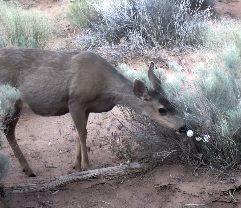
Using the 6:00 am timed entry ticket in May 2022 and driving directly to Devil’s Garden, we were able to observe a herd of Mule Deer grazing near Pine Tree Arch. These were captured using a long lens. Please respect the space and privacy of all wildlife!


Tunnel Arch
From the Devil’s Garden Trailhead- hike north 0.2 miles. The dirt path is wide and will pass through 2 wide sandstone fins. Take a right at the signed junction towards Tunnel Arch. At the 0.3 mile mark, take another right at the junction.

Pine Tree Arch-
After visiting tunnel, head back to the main path. Continue straight at the junction. At the 0.6 mile you will find Pine Tree Arch notable for the pine trees that grow under and around it. You may walk under the bridge.

Landscape Arch
After enjoying Pine Tree Arch, hike 0.2 mile back to the main trail. Take a Right to continue into Devil’s Garden. The next section of trail heads northwest for 0.5 miles. It is flat, wide and easy to negotiate. At the 1.3 mile mark keep Left to stay on the main trail. Nearby are the remains of Wall Arch. Wall Arch measured 71 feet wide, 33 feet tall when it collapsed on the evening of August 4, 2008. Just past this is Landscape Arch- measuring 290.1 feet across. Landscape is the longest arch in Arches National Park- and some say the world. Zion’s Kolob Arch was thought to be longer- however- a laser measurement showed that it was 3 feet shorter than Landscape. In 2010, Xianren Bridge was discovered in China and spans 400 feet- it is considered to be a natural bridge formation.

Navajo Arch/ Partition Arch:
The trail leaves the ground and climbs up long, thin sandstone fins for about 250 feet over 1/4 mile. At the 1.8 mile there will be a three way junction. Keep Left to visit Navajo and Partition Arches. It doesn’t matter which order you visit the arches- Navajo is slightly farther out.
Double O Arch/ Dark Angel Arch:
Return to the main trail. Go 0.4 miles in a dirt trail. At this point you return to climbing on sandstone fin. Just before the 3.5 mile mark the trail turns southwest and drops down to the Double O Arch, a structure of 150 feet with an arch imposed on top of an arch. Just ahead there is a 0.5 mile side trail that leads to the Dark Angel Arch, 125 feet tall. Make sure you look back to observe a different view of Double O Arch.
Continue back to the Double O Arch and keep Left at the junction to continue on the Primitive Trail.
The trail heads slightly away from the rock formations and heads into a wash that takes you through several fin formations. The trail descends in elevation. At the 4.83 mile mark there will be side trail option that requires squeezing through a fin formation and taking the side trail out to the Private Arch- a small formation that is very out of the way. At the 5.4 mile mark, the trail leaves the wash and turns southeast between two sandstone fins. The trail will be marked by cairns (stacked stones)- so be on the lookout. At 5.75 miles you will descend down sandstone. This area can be tricky and might require use of your hands. Just before the 6 mile mark, the trail enters another wash and turns northeast. At 6.1 mile mark the trail leaves the wash and turns south. BE ALERT- there is not a long stretch between 6-6.1 so look for the trail exit. Follow the trail back to Landscape Arch.
Park Avenue
Park Avenue: named after New York City’s famous Park Avenue. Visitors noted similarities between the rock formation and the skyscrapers- so the name stuck.
Hike Facts
- Distance: 0.9 – 1.8 miles (round trip)
- Elevation: 4,550-ft. – 4,236-ft.
- Elevation Gain: 0-ft. – -314-ft.
- Difficulty: easy-moderate
The Park Avenue Parking Area is on your left 2.5 miles from the entrance station. The Courthouse Towers Parking Area is on your right 3.7 miles from the entrance station in the shadow of massive Courthouse Towers.
Trailhead GPS (Park Avenue Parking Area): 38.624348, -109.599481
Trailhead GPS (Courthouse Towers Parking Area: 38.637085, -109.60013
Park Avenue Viewpoint: located on a paved path approximately 0.1 mile from the parking lot.
Tour: From the viewpoint, descend the steps, and follow the path into wash. The dirt path gradually shifts to rock and sliprock. One of the first formations you will pass is Queen Nefertiti, a sculpted rock formation atop the west wall, on the east side you will find sheer cliffs topped with fins. At 0.3-0.4 miles you will find two scenic side canyons. The wash eventually opens to Argon Tower, a 270 ft structure at the end of the west wall. Towards the end of the hike you will see The Three Gossips, a 350 feet structure with three summits sitting atop a pedestal base. The summits are located on the west facade and look like two people exchanging gossip.Towards the northwest you will see Sheep Rock and the Tower of Babel to the north. The trail ends at Courthouse Towers, 0.9 miles from the viewpoint. You will then reverse direction to return to your vehicle making the trail 1.8 miles.
Balanced Rock:
Follow the signs for Balanced Rock- located 9.2 miles from the Visitor Center. The trail is 0.3 miles, rated easy and well maintained. Elevation at trailhead is 5,160 feet. No shade.
Delicate Arch:
If planning to see at sunrise- you will need at least 30-60 min to reach the arch. Please remember to bring flashlights- and avoid the trail edges.
The trailhead begins at the Wolfe Ranch parking lot at 4.300 feet with Delicate Arch sitting at 4,800 feet. Expect the trail to be crowded- this is one of the most popular sites in the park, maintained, rocky and sliprock surfaces.
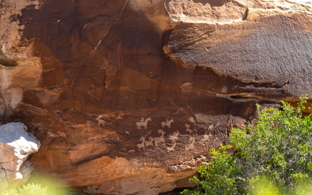
As you start off you will notice a trail on the left side that leads to petroglyphs (it is also possible to do this on the return trip). These rock art pictures are thought to be drawn by the Ute people. Most archaeologists agree that it depicts a hunting scene. There are riders on horseback, bighorn sheep, and smaller creatures that appear to be dogs.


Simply follow the trail- generally marked by cairns- or even easier- just follow the crowds!
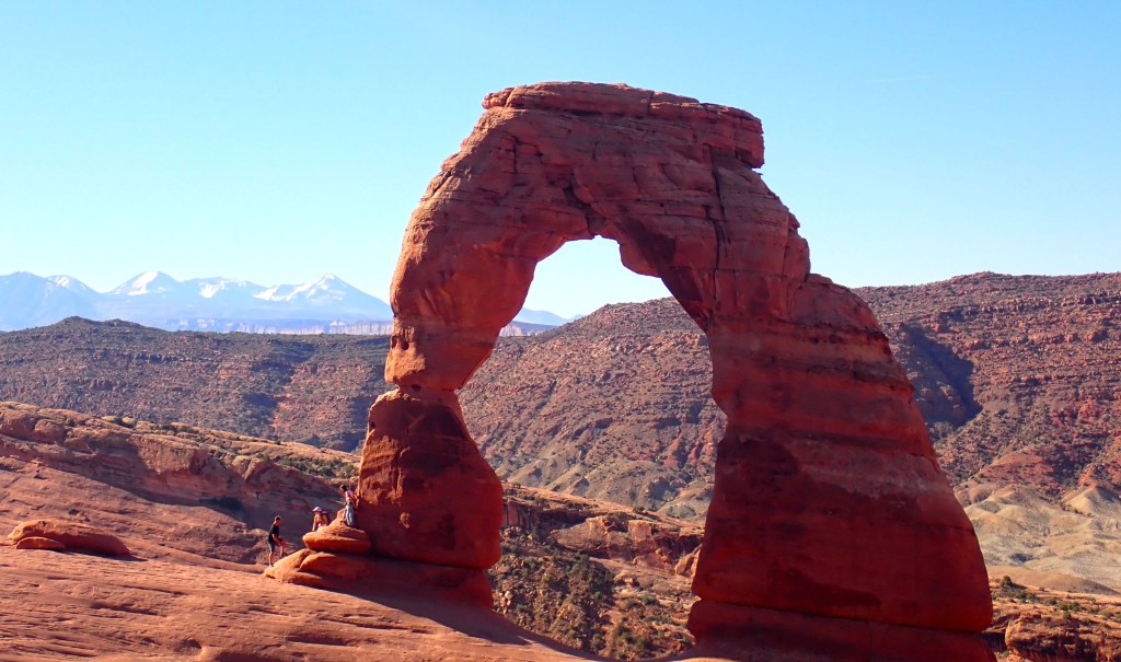
“This is by far the most delicately chiseled arch in the entire area.”
-Frank Beckwith, 1934
Beckwith was writing an article for the newspaper when he used the above description. A subheading for his article was titled a beautiful Delicate Arch and thus the evolution of the name. Cowboys referred to the arch as “Bloomer’s, The Chaps, and Salt Wash Arch.”
WINDOWS and TURRETS:
Directions: Follow the park road 9.5 miles where you will see signs for The Windows Section. Turn right past Balanced Rock and head down the road for 2.5 miles where you will reach the parking area.
Trails are located at 5,160 feet is- 0.5-2.0 miles, rated as easy and maintained (although be aware of rocks jutting out of the surface). The estimated hiking time is 30 min- 90 min.
| Trail | Distance | Rating | Elevation Change | Type of Trail |
| Double Arch | 0.5 | Easy | 20 feet | Out and Back |
| North and South Windows | 1.0 mile | Easy | 50 feet | Out and Back OR Loop (if doing the primitive trail around the back of the windows) |
| Turret Arch | 1.5 mile | Easy | 50 feet | Loop |
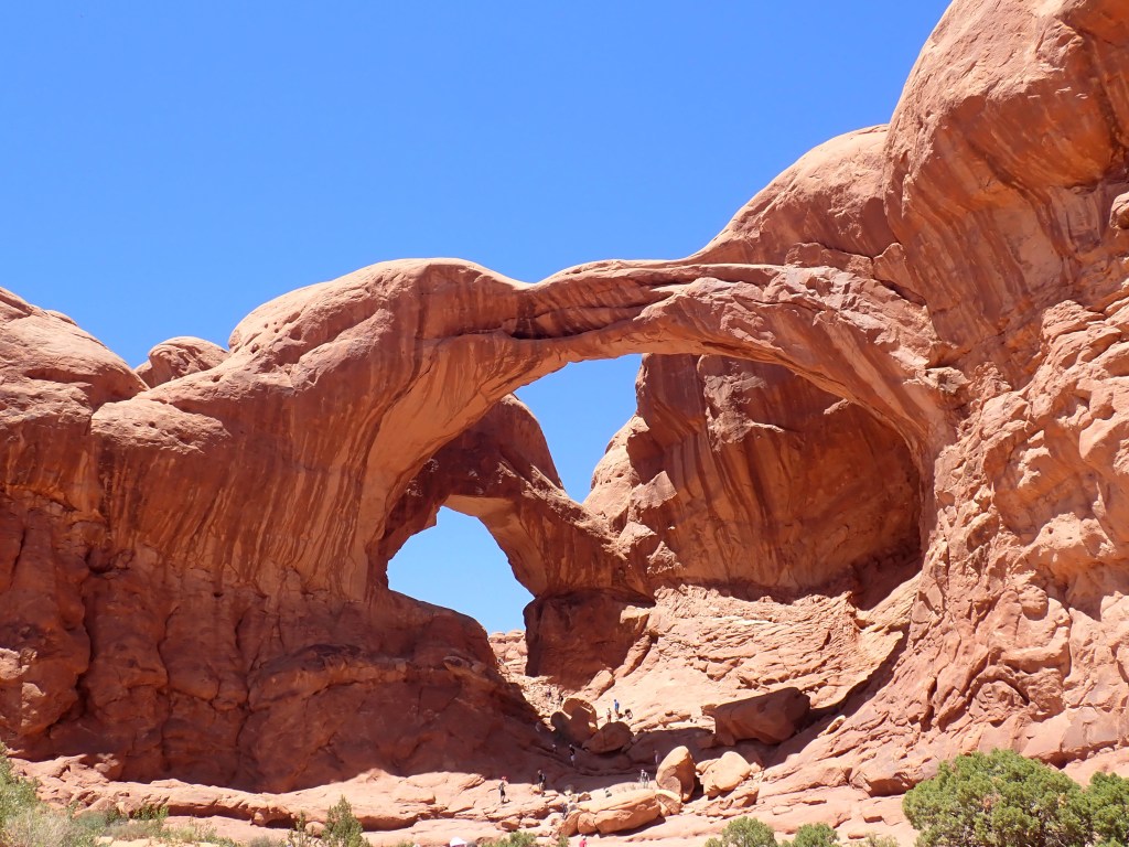
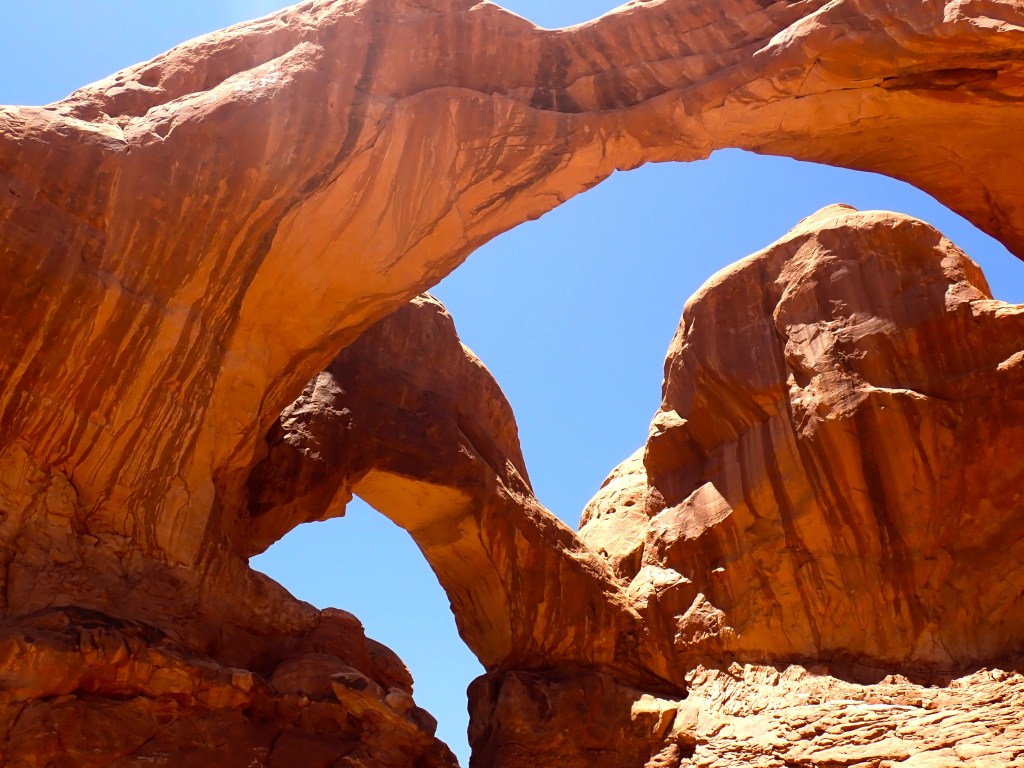
Double Arch:
The trailhead for Double Arch is on the North side of the parking lot in the windows section. It is well marked. Double Arch is the second longest and the tallest arch in the park. The trail is 0.5 mile and worth the time! Movie buffs – 1989 Indiana Jones and The Last Crusade had a scene filmed under this arch!
Parade of Elephants:
One of the first thing you notice at the Windows Section.


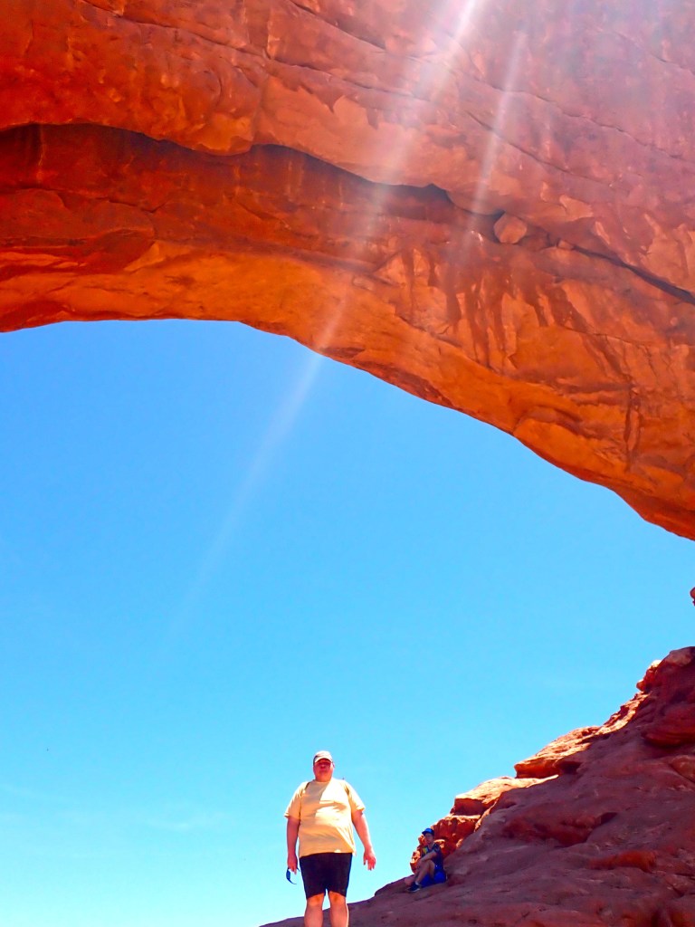
North and South Windows “the Spectacles”:
From a distance the north and south windows resemble glass. After hiking up the trail, one can stand under the South Window, a 115 foot wide and 54 foot high opening. A primitive loop exists on the backside of the windows to give one a different perspective. The North Window measures 90 foot wide and 48 feet high opening.

Turret Arch:
located on a short spur trail near the North and South Windows.

Garden of Eden:
Turn East at Balanced Rock and drive approximately one mile to a small parking lot that can easily be visited on your way to or from Windows. If going to Windows it will be on the left, leaving windows look to the right. Here you will find towering walls and fins. This is more of a lookout than an actual trail.
Tower Arch:
Located 8 miles down Salt Valley Road, this is not maintained, and is comprised of gravel. Salt Valley River road is not off Arches Scenic Drive, rather you access it near Sand Dune Arch where Arches Scenic Road becomes Devil’s Garden Road. You will then take a Left off of Devil’s Garden to Salt Valley Road. From Salt Valley Road look for Klondike Bluffs Road where you will make a left into the trail parking lot. ( Recap: Arches Scenic Road to Devil’s Garden Road to Salt Valley Road to Klondike Bluff Road).
Distance: 2.5 miles roundtrip Duration: 1.5-2.5 hours
About 1 mile into the hike- 4 spires can be spotted in the distance. These structures are known as the Marching Men. Tower Arch is impressive- spanning 92 feet.
Sand Dune Arch/ Broken Arch/ Tapestry Arch Loop:
- Distance: 2.7 miles (Loop)
- Elevation: 5,180-ft. at Trailhead
Maximum elevation – 5,275-ft. - Elevation Gain: 95-ft.
- Difficulty: easy-moderate

Go 15.9 miles from the Visitor Center to the Sand Dune Arch Trailhead (Right hand side). The trail starts out wide in a direction of sandstone fins. At the junction there will be a signed post. Turn right onto the spur trail to Sand Dune Arch. The path is sandy and is between two rows of fins. Sand Dune Arch is 0.15 miles. Beneath the arch is a sand dune- hence its name. Return to the main trail and turn right at the junction. You will now be crossing desert with sage brush, Mormon tea, junipers etc. At 0.6 miles you will reach a signed “T” junction which marks the beginning of the loop. Turn Right. Broken Arch is located toward the northeast on a fin. The approach involves a climb up slickrock to the base of the 60 foot wide arch at 0.8 miles. Look for a crack that runs through the top of the arch giving it the name “Broken Arch”. At this point you can return to the start of the trailhead (1.6 miles). Or one can continue on the path through the arch, over slickrock and then sand. Views of Devil’s Garden can be seen to the northeast. At 1.3 miles you will reach another signed junction. The spur trail for Tapestry Arch goes to the Right and add 0.3 mile to the trail. After viewing Tapestry Arch return to the junction and continue toward the Devil’s Garden Campground loop. Restrooms are located at 1.8 miles. Turn left. Walk along campground road approximately 0.1 mile looking for the trailhead to pick up near campsite #51. You will now ascend on slickrock and packed sand until mile 2.1 At this point the trail descends, continue to the signed junction at mile 2.3, turn right and head back to Sand Dune Arch trailhead at 2.7 miles.
Fiery Furnace:
A self guided walk through a labyrinth maze of sandstone walls. Can only be accessed with a ticket. It is possible to get lost in the maze and GPS trackers do not work well. Physical agility is required to navigate the narrow passages. First time hikers are advised to join a ranger tour (space is limited). For more information see https://www.nps.gov/arch/planyourvisit/fiery-furnace-permit.htm. Ranger Guided Tour is here https://www.nps.gov/arch/planyourvisit/fiery-furnace-hike.htm
Fiery Furnace Permits
If you want to enter the Fiery Furnace on your own, you must obtain the permit in advance.
- You must reserve a Self-Guided Fiery Furnace Exploration Permit online from Recreation.gov or by calling Recreation.gov at 1-877-444-6777.
- Permits may be reserved up to seven days in advance and must be reserved at least two days prior to the trip date.
- Group size is limited to six people and children under age five are not allowed. Pets are prohibited.
- Fiery Furnace permits are valid for a specified date and for day-use only (sunrise to sunset).
- All members of the hiking party must be present to watch a required educational video and listen to an orientation talk.
- Permits can be picked up the day before or the day of only at the Arches Visitor Center between 9 am and 3 pm. Permits will not be issued after 3 pm.
- Self-Guided Fiery Furnace Exploration Permits are for private use only; commercial groups are not permitted in the Fiery Furnace. You can find trails approved for commercial use in the guided interpretive day hike conditions document: Read more about commercial use.
Permits frequently sell out quickly during the busy season.
Fiery Furnace Permit Fees
The cost of Self-Guided Fiery Furnace Exploration Permits are:
- $10 per person.
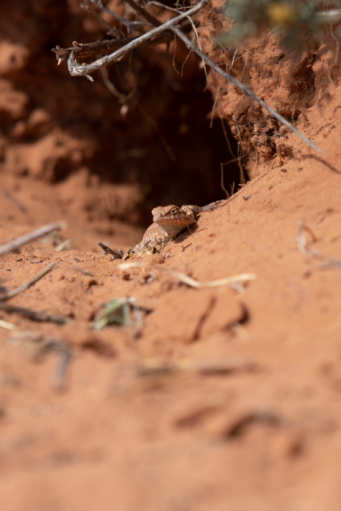
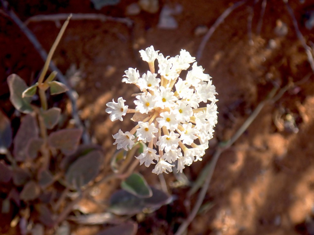
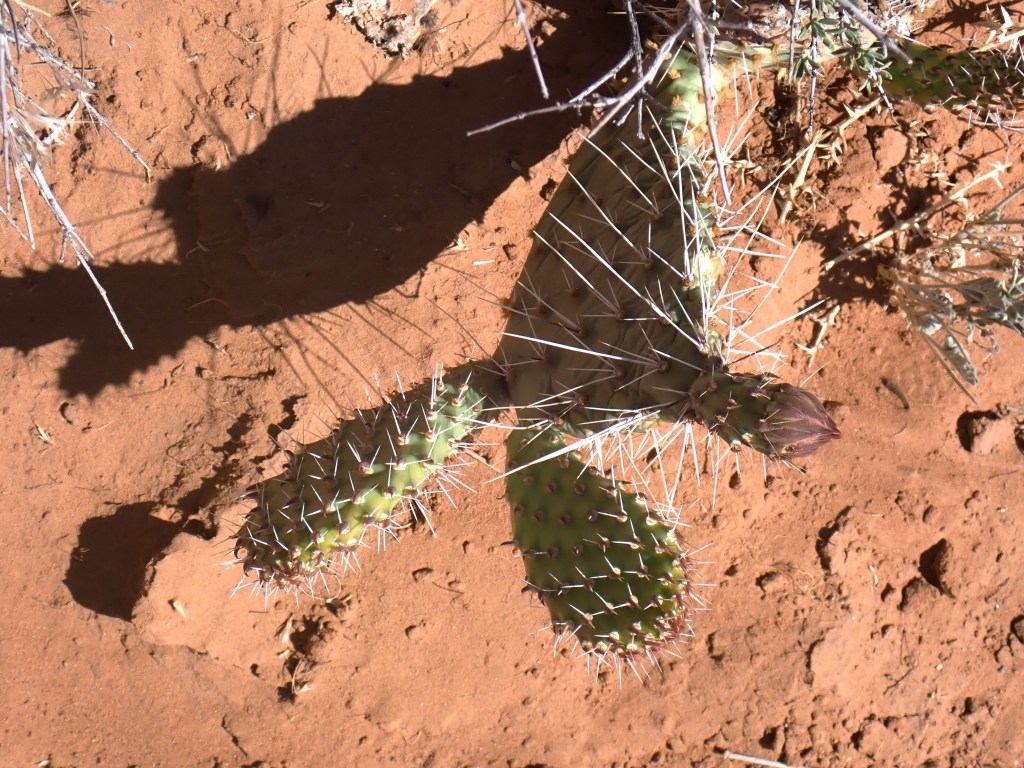
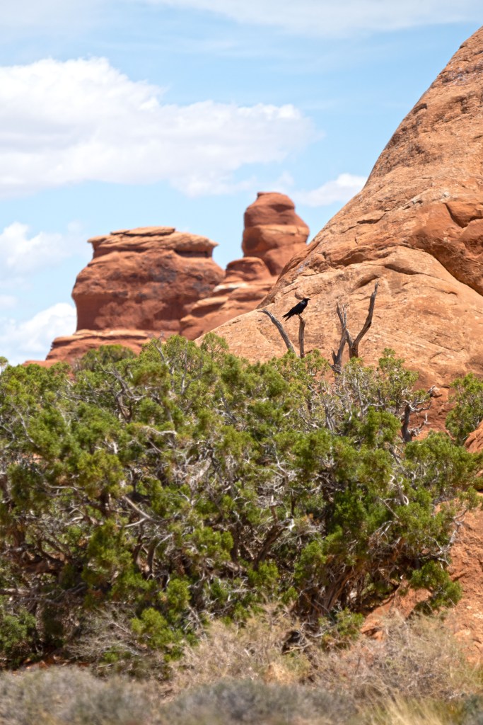
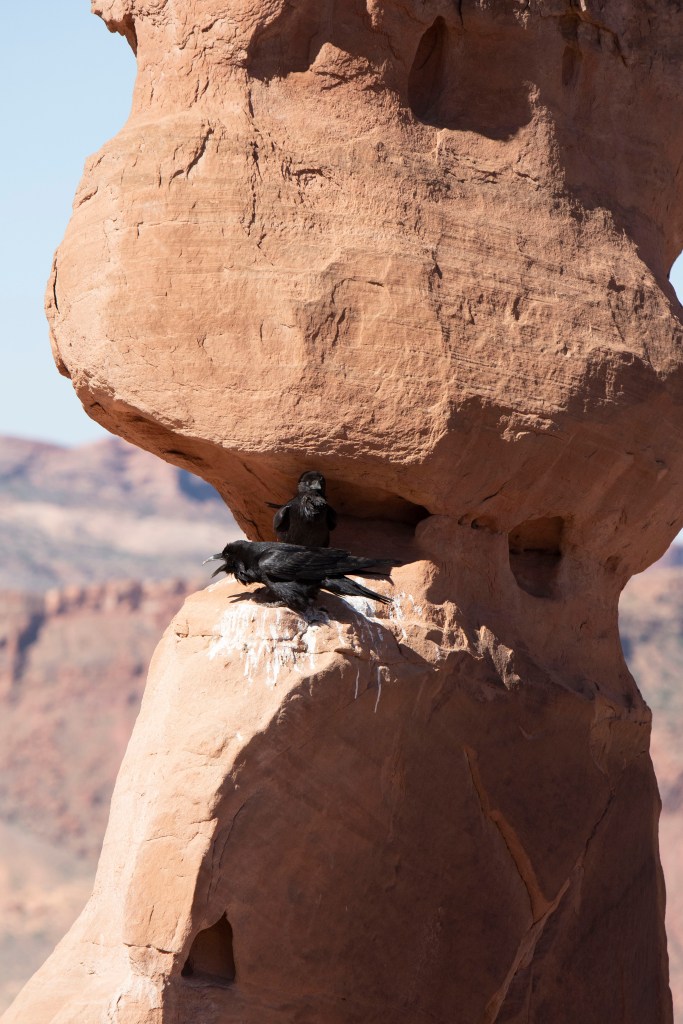
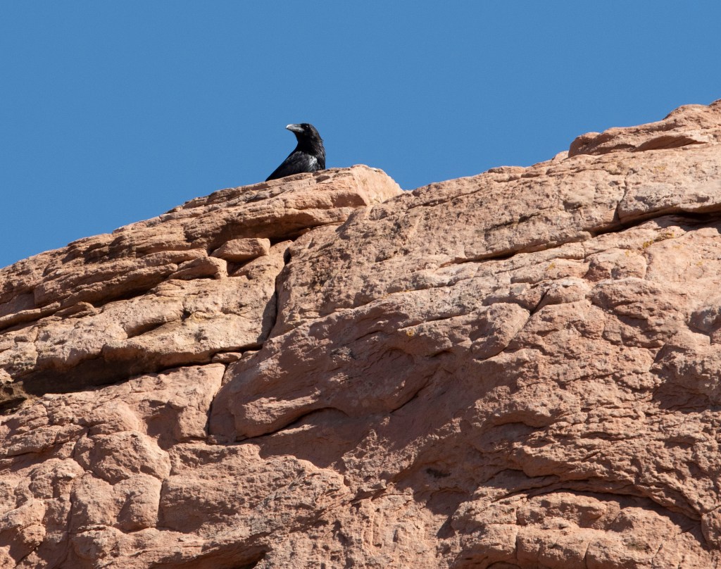
Nature is all around you!
While looking up at all the rock formations and arches- don’t forget to look down and around. These are just a few things you might see during your day at Arches National Park.


ancient publeon Casa Riconda Chacoan Great Houses Chaco Culture National Historical Park cliff palace Hugo Pavi isla mujeres Junior Park Ranger program Kivas long house mesa verde Mesa Verde audio tour mug house National Park North Beach petroglyphs Petroglyph trail Pueblo Bonito Pueblo del Arroyo Recreation.gov reviews Square House Tower Supernova tour ultramar Una Vida Wetherill mesa whale shark snorkel
