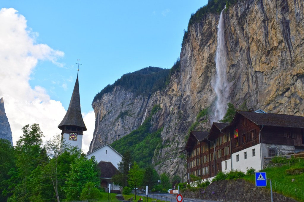
Lauterbrunnen is a quaint town in the Bern region of Switzerland that lies at an elevation of 2,631 feet (802 m) located in the district of Interlaken – Oberhasli. Its beauty lies in the mountains that surround its valley, and in the amazing 72 waterfalls within its borders.
“The Soul of Man, Resembleth water: From Heaven it Cometh, to Heaven it Soareth and then again to Earth descendeth, changing ever.
-J.W. von Goethe
Famous Waterfalls:
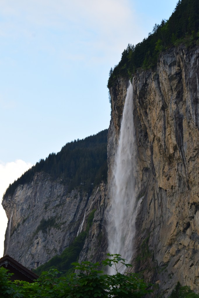
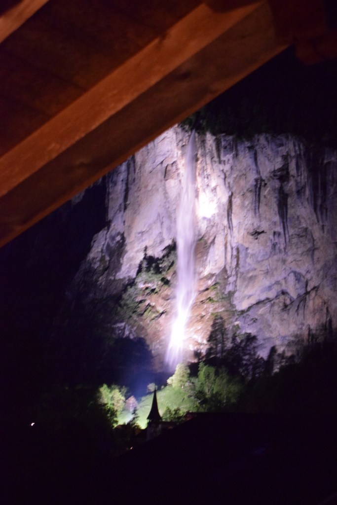
Staubbach– is the iconic landmark of Lauterbrunnen. It is one of Europe’s highest, free falling waterfalls.
Trummelbach– 10 glacier waterfalls within a mountain.
Talbach- located in the upper valley
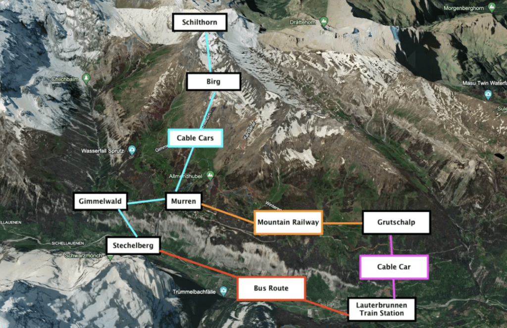
The map above shows the small size of Lauterbrunnen. You can arrive in the town via train, cable car, or car/bus. If you are driving, the easiest place to park your car is in the extensive lot near the train station (pay parking). The parking garage connects to the railroad station by going up the stairs to the left. The station is one of the many stops on Grindelwald/Interlaken route. Train tickets can be purchased online, station kiosks, or at the manned ticket booth. Purchasing online saves you the hassle of credit cards not working. If you are taking the cable car up to towns above Lauterbrunnen- then follow the steps to the right. You can purchase cable car tickets at the kiosk or manned window. We had difficulty using our Visa cards- luckily Discover worked just fine. So beware- and have some cash available in case your card does not work on the system.
When To Go:
Over the years, I have come to correlate the start of summer on the “unofficial” American custom of Memorial Day. Unfortunately, this is not a good practice for Switzerland- the seasons are much different and it pays to know what you want to do, and when you can do it.
Season
Dates
Spring
April- mid June ( June 15 or later)- Limited Opening
Summer
mid- June- early September- Everything Open!
Fall
mid-Sept- October- Limited Opening
Winter
November- April- Everything Open
If you are planning to hike and you want to have a wide selection of trails- then you need to come in Summer. Hiking trails are limited in the Spring based on snowmelt- so your selection will vary and higher altitude trails are like to have too much snow. You can check the trail opening status here https://lauterbrunnen.swiss/en/service/operating-status/status-of-installations.html Another way to assess trail openings is to look at the cable car timetable. If the cable car isn’t stopping in the location of your trail, then the trail is most likely not accessible. Sometimes, you can hike to the trailhead from another cable car stop- in those situations- you really need to do your research and read as many blogs as you can. Hiking is not the only activity affected, if you plan to eat at mountain huts or restaurants on mountain peaks- you must be aware of the opening dates and hours. Many restaurants, both in the mountains and the valley, close during the limited opening seasons. Unfortunately not all restaurants post their closing schedules- so check and double check so you are not taken by surprise.
One Day in Lauterbrunnen
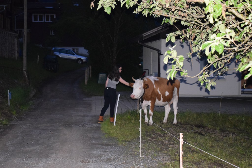
We had only one day (and a night) in this town- BIG MISTAKE! Our trip was already approaching max length and we snuck this in on our way to Zermatt. Don’t short change this region- there is so much to do! You can explore the Jungfrau Mountain at 13,642 feet (4,158 m), the Schilthorn at 9,744 feet (2970 m), the filming location of the 6th James Bond 007 movie. There is even a restaurant at the peak! There is paragliding, canyoneering, waterfalls, and so much more to explore- you really could easily spend a week in the region. We chose to spend a night in a chalet- which was not only surrounded by the best scenery but the cows next door kept us musically entertained with their bells at night. We had dinner in town and then half of our group went canyoneering and the other half went hiking on the following day.
Cable Cars/ Funiculars
1). Know your time schedules! Weather can change quickly at higher altitude and you might decide to take the cable car down instead of hike in the rain- so knowing that last departure time is essential! Additionally, altitude impacts people differently. Some may find that they have less energy- or moving requires more breaks. It’s important to listen to your body and allow it to adjust to the altitude- so if you need to use a cable car- do so!
2) Tickets can be purchased at the cable stations- again- visa cards can be temperamental, so be certain you have a back up payment method at all times.
3) There is no assigned seating on funiculars, or mountain trains- first come, first served. Cable cars are standing only. They can be very packed with people, backpacks, luggage, and skis, but the views are fabulous!
4) There is no way around it- cable cars/ funiculars are expensive. You can get discounts if you have a Swiss Rail pass or similar card. If you are planning to hike down, then only purchase a one way ticket. If you decide to ride down later- you can purchase a ticket at the station where you want to begin your decent.
5) Cable cars/funiculars/ Trains- they leave on time! Don’t count on them “running behind schedule”.
6) You will need your cable car/funicular ticket to enter and exit the station- so hold on to it!
Dining
Food is expensive. You won’t find a McDonald’s in Lauterbrunnen, although there is one in Interlaken (about a 20 min drive). Expect to pay $25 chf for a hamburger ($29.33 usd). Reservations are essential at more popular or smaller venues. Trip Advisor has excellent reviews of most eateries. The tap water is safe to drink in Switzerland.
The chalet is located at the far end of town (so away from the train station) nestled several streets back from the main thoroughfare. There is parking available and GPS leads you right to the place. There are cows with awesome cow bells across the street which adds to the festive atmosphere. The chalet had 3 bedrooms, a loft (which our college aged daughter loved), a kitchen, bathroom, living room and a front porch/balcony. There was plenty of room for our family of 5 adults. If you are looking for a place to stay- check this one out!
Fifth photo, bottom right: our guest house was Chalet Bärgstäger; Bärg, Swiss German “mountain” to Standard German’s “berg”, and Stäger, Swiss German “stable hand”; the words together are “Mountain Stable Hand”, appropriate for farming people who live amidst the Alps; Swiss German, standard and localized, is liberal with the umlaut (the dots above letters) in spelling
This is the company we used for those who went canyoning- and they had the most fantastic time! Due to heavy rains several days prior, the original destination had to be changed. The staff did a wonderful job contacting us as soon as they were concerned about the swelling water in the canyons. They created a new agenda that offered similar chills and thrills in a safer venue. We traveled by train from Lauterbrunnen to Interlaken (3 stops- approximately 20 min). We were met at the Coop (a large supermarket) directly across from the train station. We were able to don wet suits, helmets and other necessary gear without problem and then it was off for climbing, sliding down into pools of water, jumping from cliffs. It was everything we could have asked for packed into one happy, exhausting 6 hours of excitement. So if you are looking for outdoor fun (summer or winter) adventures- be sure to consider Outdoor Switzerland- they were friendly, responsible, operated with the highest safety standards and made certain that everyone left happy.
Towns Above Lauterbrunnen:
Many of these towns are accessible by hiking up, cable car, funicular, or train. Most are car free. All are charming and can serve as base or pleasant stops for exploring/hiking the region.
Cumulative elevation gain and loss for the trail is +1,700-ft./- 1,200 -ft (+518-meter/-366-meters).
There are lots of hikes in this region- we chose this one because it was open in early June (5th), and had amazing views of the mountains (Eiger, Monch and Jungfrau). It was a bit daunting heading off on this hike in a country where English was not the primary language. So here’s how it went:
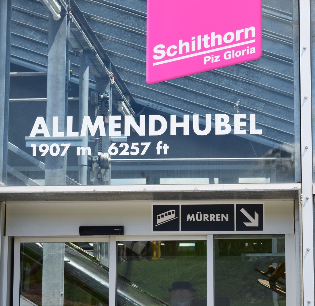
Pack Well- you need water. 2 liters/person is ideal. It gets hot on the climb- not from the exertion, but from the sun beating down with no shade, plus- altitude dehydrates you more quickly. Once you exit the cable car at Grutschlap there are no restaurants/food/beverages until you reach Allmendhubal (about 1-2 hours later of steady uphill climbing). So be prepared. Hiking boots will give you more stability in your ankle over rocks, rolling pebbles, potholes in fields etc. Do carry a first aid kit, and sunscreen is essential. Make sure you layer- it will be chilly in the morning and warm up quickly. Walking poles/sticks can be extremely helpful in easing uphill exertion and providing stability on uneven surfaces. Camera- (and that spare battery and photocard) because you will take a MILLION pictures.
If you are not used to altitude- you might find hiking here a bit more challenging (we live at sea level in Massachusetts). There is no way to predict who will or will not be affected by altitude- so take your time.
Maps or description of trail- always handy to bring along.
So let's begin:
We drove from our chalet to the train station parking lot (about 5-7min), parked and followed the signs to the cable car for Grutschlap. We needed to buy tickets our visa cards (3 of them) would not work in the ticket machine so we headed to the window and were still unsuccessful. Luckily Discover did the job and we purchased our one way tickets up.
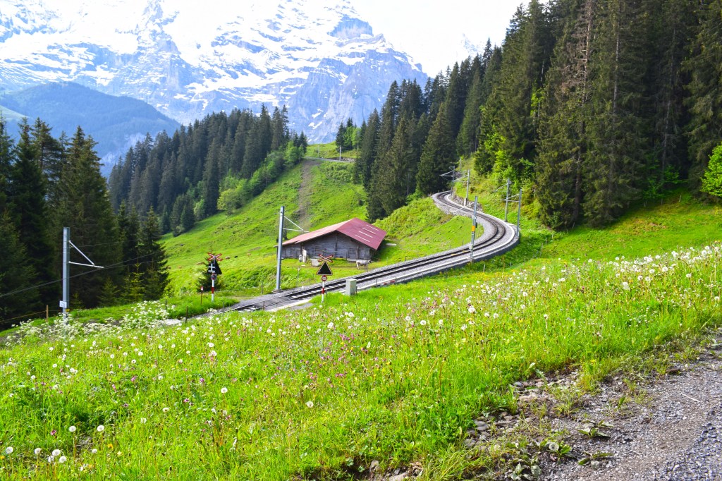
The cable car trip lasts 4 minutes and runs about every 30 min. left at about 8:15 and it is just a short, but stunning ride up to Grutschlap. At Grutschlap you exit the cable car. There are restroom facilities. A eatery was not open at this early hour. Here you can board a train that will take you directly to Murren. Or, if you prefer, you can hike. There are two routes that will take you to Murren- one is at or below the tree line and follows the railroad. That is the easier of the two. The second- THE MOUNTAIN VIEW TRAIL- goes up above the tree line, keeping the mountains in view towards your left. We chose to go up toward Allmendhubal before descending to Murren.
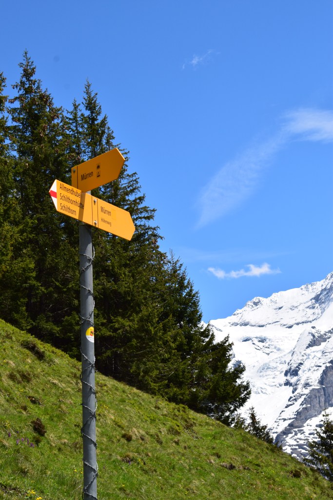
To access the hiking path- exit the door (snap your picture with the Swiss cow- because it’s the thing to do). Go past the refreshment stand, cross the road and you will see the entrance to the trail. GO UP. This will be marked with a sign that says Murren via Winteregg (1 hr 15 min) for the lower trail and Mountain View Trail (#351) which travels through Bletschenalp (1h) and Almmendhubel (2hr 30 min) to Murren (3hr 10 min). Walk a short distance to a junction- turn RIGHT (southwest) for the Mountain View Trail. The trail ascends sharply through the woods with tantalizing glimpses of the mountains. The Mannlichen Ridge rises across the valley in the east. You will cross through meadows- be sure and close the gates behind you!
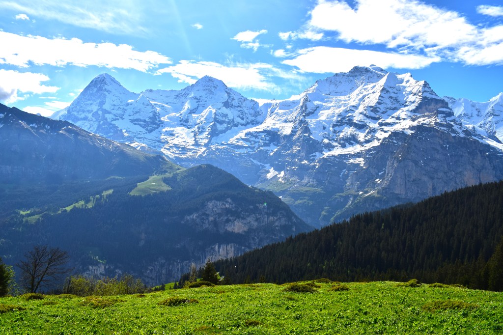
About 0.8 mi (1.3km) you will see a small farm. At the junction, Bear left to stay on the trail #351 toward Bletschenalp and Allmendhubel. As the trail emerges from the woods, you will see another junction- turning left takes you on the low path to Winteregg- Murren. Continue upwards on Mountain Trail #351. You will now have views of the 3 mountains (Eiger, Monch, Jungfrau) along with the Gletscherhorn, Abeni Flue and Mittaghorn, rimming the east side of the upper Lauterbrunnen Valley.
Continue straight through meadows. Ups and downs, crossing a few small streams and following the trail signs to Allmendhubel
At 3 miles you come to a 5 trail junction at Hohlucke- turn left to continue on Mountain Trail 351 towards Allmendhubel. The path leads down to the Allmendhubel Flower Park. Once in Allmendhubel you can opt to take the funicular to Murren or you can hike. To hike- follow the signs to Murren down through meadows, cows, forest until you reach the town.
Identifying the Big 3: Eiger, Monch, Jungfrau
Map Courtesy of: Wikipedia
Identification is from Left to Right:
Eiger- is 13,025 feet (3,970 m)- the name may arise from the Latin word “acer” meaning sharp, pointed. It could also be attributed to the German word “ger” meaning spear or javelin.
Monch- is 13,448 feet (4090 m) derives from the German word meaning “monk”
Jungfrau- is 13,642 feet (4,158 m) means “virgin”. This may be attributed to a group of Interlaken nuns who had a convent dedicated to the Virgin Mary.
The Legend of the Three Mountains:
One day a poor man comes knocking on the door of a local family begging for a glass of milk. The family refuses and declares that the man is only worthy of water. Unbeknownst to the family, the poor man was actually a powerful mountain spirit. He rewarded their act of unkindness by causeing the family to grow into giants and turn into snow and ice. The father became Eiger, the son Monch, and the daughter, Jungfrau.